News
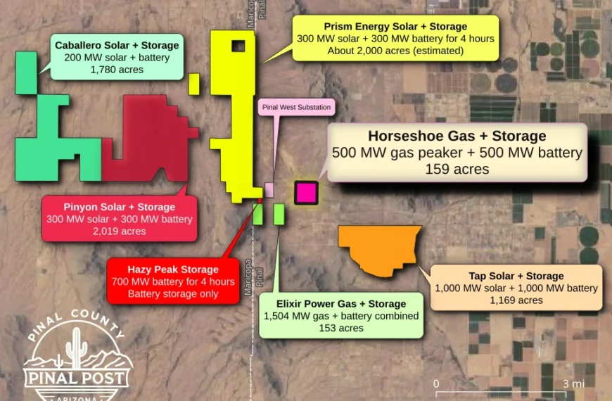
Horseshoe Energy Project Returns to Pinal P&Z Oct. 15 After Commission Delays Decision on Gas Plant Expansion
The Horseshoe Energy Project heads back to Pinal County commissioners…
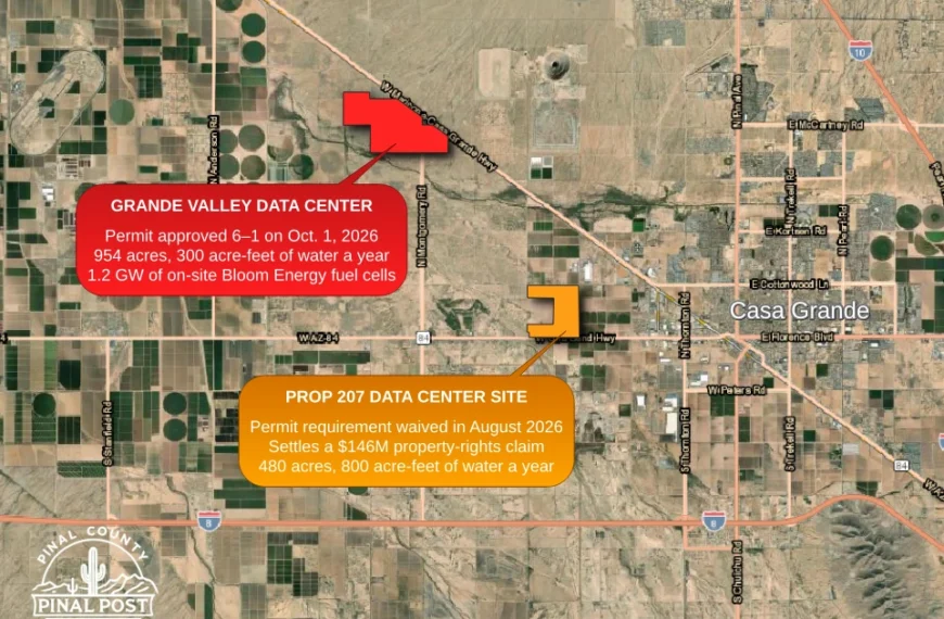
Casa Grande Data Center Permit Approved for New Campus, Separate From Prop 207 Waiver Site
Another Casa Grande data center, separate from the Prop 207…
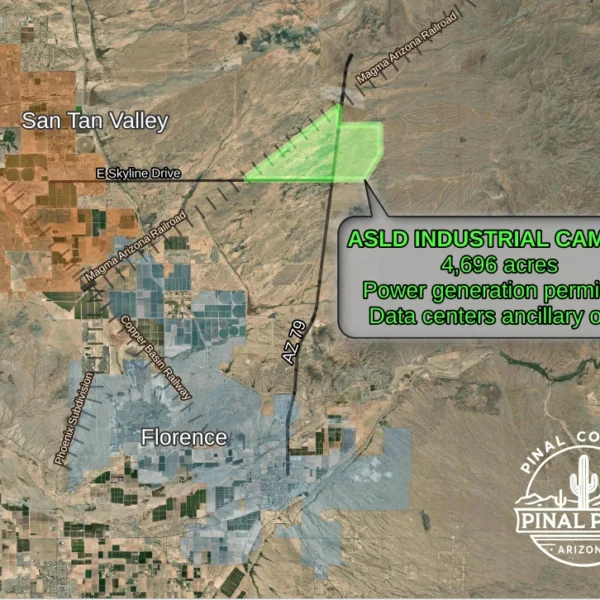
4,696-acre SR 79 industrial rezoning approved; employer could generate its own power and run an ancillary data center
An employer could run its own data center and generate…
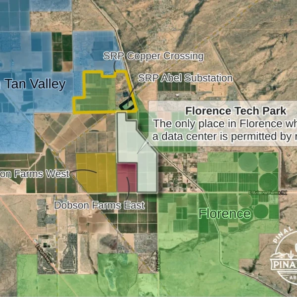
Florence Data Center Committee Learns Where Data Centers Can Go and How the Town Can Regulate Them
Florence Tech Park (outlined in white) is the only place…

State 48 Microschool Permit Vote Delayed as County Weighs What Counts as a School
County supervisors delayed a vote on the State 48 Microschool…
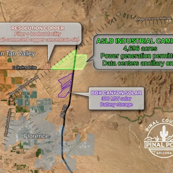
Employer’s own data center could be part of 4,696-acre industrial site along SR 79 under P&Z-recommended plan
Nearly 4,700 acres of state land along SR 79 could…
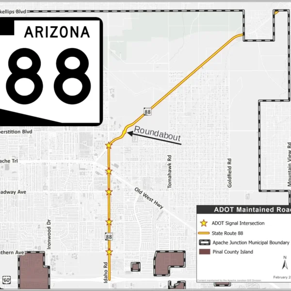
Apache Junction Council Members Back Taking Stretch of SR 88 From ADOT
Apache Junction could take over the stretch of State Route…

SunZia Can Now Carry 3,000 MW of Wind Power to County; SRP Buys 600 MW
Wind power from New Mexico now travels 550 miles to…
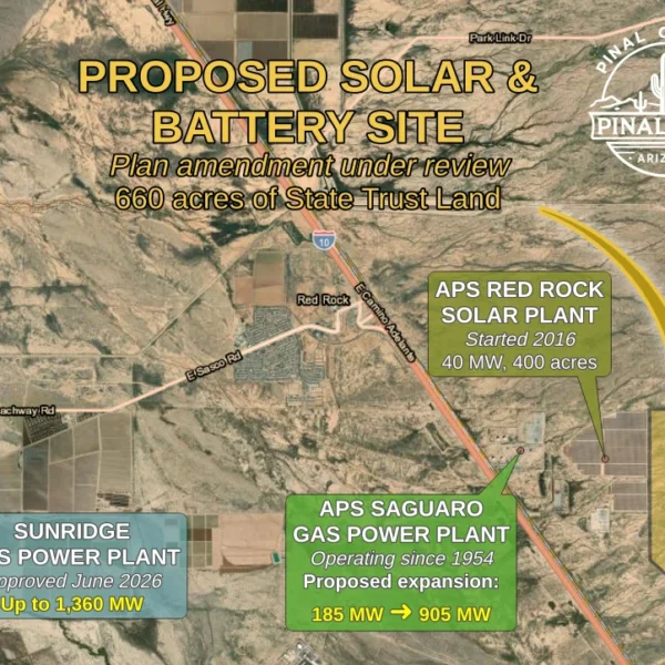
Red Rock energy hub could grow: 660-acre solar and battery site proposed on state trust land
A utility-scale solar and battery facility on 660 acres of…
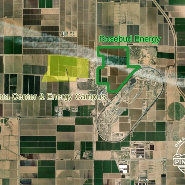
Rosebud Energy Project Would Put Solar Panels and Batteries on Nissan-Owned Farmland Near Maricopa
Pinal County is reviewing the Rosebud Energy Project, a solar…
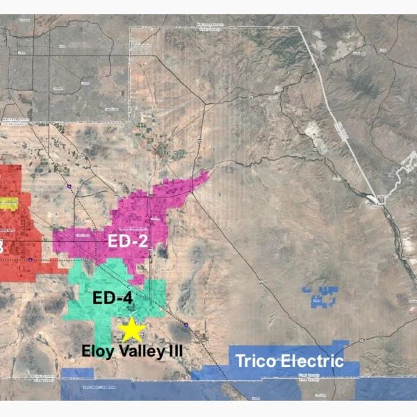
Eloy Valley Energy Center III Approved: 400-Megawatt Solar and Battery Project Planned South of Eloy
NextEra’s Eloy Valley Energy Center III, a 400-megawatt solar and…
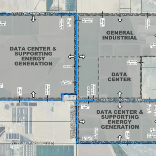
Data centers proposed south of Maricopa: County reviews 956-acre land-use change for Arizona Independent Technology Campus
The full rezoning could eventually cover about 1,517 acres, though…
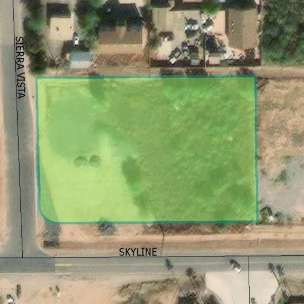
San Tan Valley Parks Hinge on Partnerships as Town Waits on Revenue
San Tan Valley’s first youth practice space may come through…
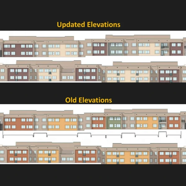
Staff signals support for revised Banyan Apartments plan as council members question support letters
Banyan Residential’s revised plans for 146 income-restricted apartments at Virginia…
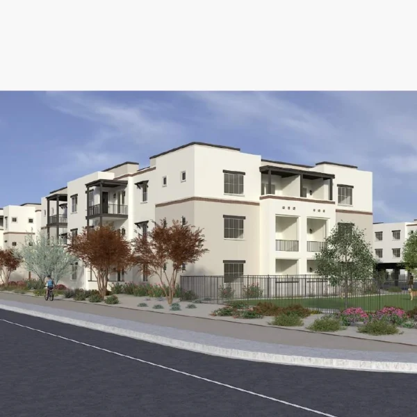
Downtown Apache Junction’s Bella Norte apartments split planners in 3-3 tie, sending decision to council
Apache Junction planning commissioners deadlocked 3-3 on Bella Norte, a…
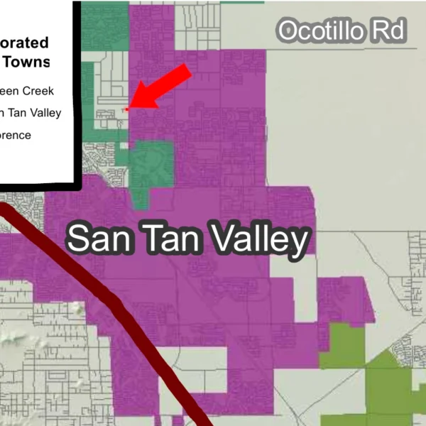
San Tan Valley Annexation Review Points to September Rezoning Case
San Tan Valley’s new Planning and Zoning Commission reviewed the…
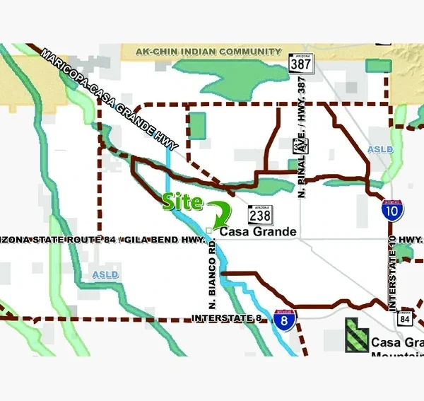
Desert Crest Battery Storage Advances West of Casa Grande
A 350-megawatt battery facility cleared its first hearing west of…

A Vaquero’s Heirs and a Data Center
A Mexican vaquero built a ranch on the La Osa…
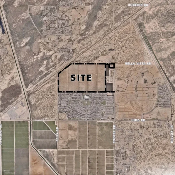
‘Profit-driven, not economy-driven’: chairman challenges Barcello Farms lot sizes
Planning commissioners delayed a recommendation on the 1,052-home Barcello Farms…

‘One hundred percent not true’: SRP’s answer on data centers and your power bill
“At least in SRP territory, that is one hundred percent…

The Oldest Question in Land Use
Supervisor Stephen Miller says property rights should carry the La…

Pinal County Data Centers: UA Expert Briefs Supervisors
University of Arizona computing expert David Ebert told Pinal County…

Hunt Highway and Felix Road Corner in Florence Rezoned for Smaller Homes, With Commercial Staying
Florence council members have cleared the way for 80 to…

Florence Data Center Advisory Committee Seats First Members
The Florence Town Council appointed the first seven members of…

Ore Town Solar Approved on San Manuel Mine Land Deemed Unfit for Most Development
Pinal County supervisors approved the Ore Town Solar project with…

Casa Grande Commission Approves Up to Three Drive-Thru Restaurants on Florence Boulevard
Casa Grande’s Planning and Zoning Commission approved a conditional use…

New Police Substation, Library and Park With Fishing Lake Coming to Apache Junction
A new police substation, branch library, and community park with…
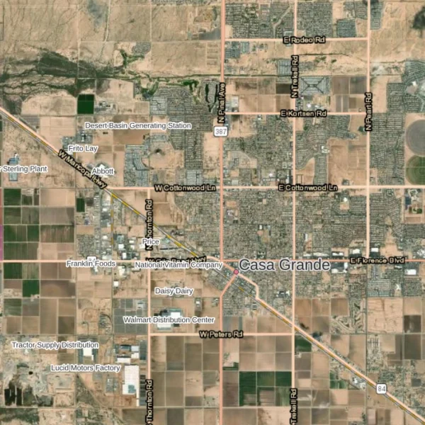
Casa Grande Approves Data Center Waivers 7-0 to Settle Prop 207 Claims
The city agreed not to require a conditional use permit…

Eloy Valley Energy Center III: 1,263-Acre Solar and Battery Rezone Advances
Pinal County planning commissioners voted 7-1 to advance Eloy Valley…

Coolidge Approves 160-Acre Site for Clark Pacific Concrete Building Components Plant
The Coolidge City Council unanimously approved a 160-acre site for…