Guest opinion column by Eirini Pajak of Pinal Unlocked, published in Pinal Post’s Opinion section. Views are the author’s own.
LA OSA DATA SERIES
Part 4 of a Series | Case No. PZ-003-26 and PZ-PD-003-26
In parts of Pinal County, the ground has been quietly splitting open for decades. The cracks run for miles, drop tens of feet, and are sometimes wide enough to swallow livestock. They are called earth fissures, and the area around Eloy and Picacho has more of them than anywhere else in Arizona.
This is in the vicinity of what has been described as Arizona’s largest proposed data center hub.
Quick Look
- The La Osa site sits in Arizona’s most fissure-prone basin. Roughly 70 of the state’s 170 miles of mapped earth fissures are concentrated in the Eloy-Picacho area.
- Fissure movement at the Picacho earth fissure is highly correlated with groundwater levels. As water levels fell, the fissure widened; as they recovered, it narrowed. The underlying compaction does not reverse.
- No site-specific geotechnical report or fissure assessment was submitted. Both are scheduled for the site plan stage, after industrial zoning is already granted.
- Part of this land is in a Federal Emergency Management Agency (FEMA) high-risk flood zone, with off-site flows estimated at 10,000 cubic feet per second. A complete flood analysis is scheduled for after the rezoning vote.
- Federally listed species are documented on or near the site, but formal Endangered Species Act (ESA) consultation has not been initiated. This is not only an environmental question: unresolved federal consultation can delay construction long after the zoning is granted.
- The county’s leverage is highest before the vote. Once industrial zoning is granted, taking it back is much harder, and commitments left in the project narrative rather than the binding stipulations may not be enforceable at all.
The application acknowledged subsidence (the gradual sinking of the ground) in the region in general terms. It did not include an independent geotechnical report on site-specific fissure risk, settlement risk for the proposed structures, or the relationship between the project’s water demand and the local subsidence rate. Deferring these analyses to the site plan stage is standard practice in Pinal County rezoning proceedings.
This Basin Is Already Unstable
Before considering what a data center would do to this ground, it helps to understand what the ground is already doing on its own.
What an Aquifer Is
An aquifer is not an underground lake. It is a layer of porous sediment, sand, gravel, and clay, that holds water in the spaces between particles, the way a sponge holds water in its pores. According to the U.S. Geological Survey, when water is pumped out faster than it is naturally recharged, the subsoil compacts and the open pore spaces that held the water shrink in size and number.
A sponge re-expands when released. Aquifer sediments, once compacted, do not. According to Conway (2015) and a peer-reviewed analysis of land subsidence in southern Arizona, where aquifers contain fine-grained sediments like those in this basin, compaction permanently reduces groundwater storage as pore volume collapses. Both the Arizona Department of Water Resources (ADWR) and the Arizona Geological Survey (AZGS) describe this loss as permanent: in this basin’s sediments, the storage capacity that is lost does not come back.
What Has Already Happened Here
According to ADWR, land near Eloy has subsided up to 19 feet since the 1950s. ADWR uses InSAR (Interferometric Synthetic Aperture Radar) satellite monitoring to track ongoing subsidence in the area.
As the ground subsides unevenly, the differential movement creates cracks that extend from the surface downward. These are earth fissures. According to the Arizona Geological Survey (AZGS) Earth Fissure Program and a peer-reviewed analysis of land subsidence in southern Arizona, the Eloy-Picacho area is the most fissured part of the state, with approximately 70 of Arizona’s roughly 170 miles of mapped earth fissures concentrated there. The first earth fissure in Arizona attributed to groundwater withdrawal was discovered near Picacho in the early 1950s, according to Conway (2015). A Tucson.com investigation documented one fissure south of Eloy measured at 1.8 miles long, 10 feet wide, and 27 feet deep. Critically, fissures often exist underground before they ever reach the surface. AZGS notes that the visible fissure floor does not reflect a fissure’s true depth, and that fissures are believed to extend down toward the water table, sometimes several hundred feet below ground. They can stay hidden until monsoon erosion or continued subsidence opens them.
Chris Wanamaker, then a Pinal County engineer, described how it happens: a small crack appears where the ground has dropped from over-pumping, and then, as he put it, “a heavy rain brings water runoff into the crack, which can cause the land to erode suddenly as it collapses into the void.” Fissures, he noted, can open overnight, usually after the summer monsoon. In Pinal County’s Queen Creek area, a homeowner discovered a fissure beneath her house on a property the county had issued a building permit for in 2001. There were small holes in the yard and nothing to indicate a fissure ran beneath the house. A site showing no cracks today is not necessarily a site without fissures, which is why a surface look cannot substitute for a subsurface geotechnical investigation.
The Pumping-Fissure Link
A U.S. Geological Survey (USGS) study of the Picacho earth fissure by M.C. Carpenter measured a correlation of approximately 0.92 between groundwater level fluctuations and horizontal fissure movement from 1980 to 1984. As pumping drew water levels down, the fissure widened slightly. As levels recovered, it narrowed slightly. The movement was small, measured in millimeters, but it tracked the water levels almost in real time.
Decades of heavy groundwater pumping have driven water levels in the Eloy area down by roughly 400 feet over time, according to the City of Eloy’s water resource planning. How the proposed project’s water demand would affect the local subsidence rate has not been evaluated.
A common argument is that replacing irrigated farmland with a data center reduces the basin’s overall water demand. On volume, that is largely true, and Article 3 of this series examines the water accounting in detail. But this article is not a volume argument. Farming is forgiving of unstable ground: a field can flex, fallow, and resettle. A 400,000-square-foot slab and the buried infrastructure around it cannot. The question here is not how much water the site uses compared to farming, but whether this specific ground can bear this specific kind of permanent, rigid construction, and that question turns on the studies that have not been done.
Why This Matters for a Data Center
Why does the unstudied ground matter so much for this particular use? Because data centers require extraordinary structural stability. According to industry engineering analysis of data center slab design, floor flatness and levelness requirements exceed traditional commercial and industrial standards, and the slabs must remain stable for the life of the facility. Once a slab is poured, it is rarely altered. Any later repair risks disrupting operations that are built to run nonstop, so the stability has to be right from the start.
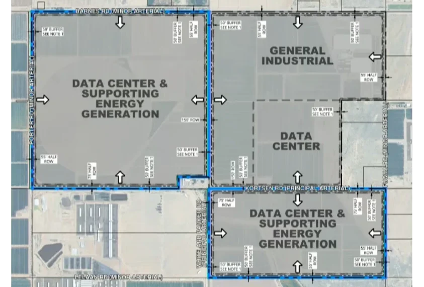
The La Osa application covers approximately 3,385 acres in total: 2,393 acres would be rezoned to I-3 Industrial and 992 acres would remain as open space. On the industrial portion, the project proposes 59 buildings, with individual structures reaching up to 400,000 square feet. According to engineering analysis of differential settlement in large industrial facilities, large-span buildings span distances where soil conditions can change significantly, and without proper site investigation those variations translate into uneven structural movement. The larger the footprint, the greater the exposure.
Standard engineering can address settlement, proximity to an active subsidence zone, and groundwater-driven movement, but only once the site-specific studies have been done. Here, those studies have been deferred.
The concern extends to buried infrastructure. A campus of this scale depends on water lines, stormwater systems, utility conduits, gas infrastructure, and communications corridors spread across thousands of acres. In Arizona, earth fissures have damaged pipelines, highways, roads, railways, and flood control structures, and a study of subsidence hazards to natural gas pipelines found that horizontal displacement in areas of active groundwater pumping can compromise pipeline integrity.
What Has Not Been Studied
The hazards above are documented. What the application leaves open are the site-specific questions, beginning with the one the county has already flagged: flooding.
Flood Risk and the Underground Pathway
The fissure conditions described above are what make the flood analysis more than a surface drainage question. Runoff entering a fissure does not stay at the surface; it travels down the open conduit toward the aquifer.
The flood analysis is the first of the deferred studies, and the county has already flagged it. A portion of the La Osa property lies within a FEMA Zone A floodplain associated with the Greene Wash watershed. At the November 19, 2025 Board of Supervisors hearing, Pinal County Planning Supervisor Sangeeta Deokar stated on the record that a large portion of the site falls within a major flood zone and that detailed hydrological studies would be required. She added that additional geological and geotechnical reports and analysis were warranted, an acknowledgment from the county’s own staff that the site’s suitability had not yet been established. The project’s own preliminary drainage report estimates off-site flows of approximately 10,000 cubic feet per second and acknowledges that no previous drainage studies had been completed for the property. A complete flood analysis is scheduled for the site plan stage, after zoning is already granted.
The retention basins are described by volume but not yet by location. Across all three drainage areas combined, they would need to hold roughly 412 acre-feet of stormwater, by the report’s own calculations, placed “in locations best suited to service the development layout once the design has progressed.” County staff repeatedly described the site plan at the hearing as schematic and conceptual. That matters more here than it might elsewhere, because the site is a long, narrow corridor following Greene Wash, threaded between the floodplain, two transmission-line easements, and a gas pipeline. There does not seem to be much spare room for basins large enough to hold the required volume, and the project’s drainage exhibit reflects this: it maps the drainage areas, the flood zone, and the building pads, but not the basins themselves.
The site’s soils are also mostly slow-draining, so the report’s plan is to bleed retained water off through drywells, engineered shafts that carry it downward to meet the county’s 36-hour drain-down requirement. That pathway is the one the contamination concerns below turn on.
The flood exposure was not lost on the commissioners. At the April 16, 2026 hearing, Commissioner Tom Scott raised the project’s position “right on the edge of the floodplain” of the nearby river and asked what steps would be taken “to keep the river where the river needs to be and not on your project.” Court Rich of Rose Law Group, representing the applicant, Vermaland, answered that the developer would work through the county flood control district and “do every single thing they tell us to do and more,” and would release water without negatively affecting downstream property.
The applicant’s flood mitigation works at the surface: buildings elevated above the flood line, flows routed through the open space corridor. It does not address what happens underground. Clean stormwater soaking in is beneficial recharge; the concern is what happens when the water is not clean. Normally, soil filters water on its way down, holding back metals and breaking down pollutants before they reach the aquifer. A drywell or fissure skips that step. Peer-reviewed research confirms drywells can send water past much of the soil’s filtering layer, which is why these systems carry a contamination risk: polluted runoff bypasses the soil that would otherwise clean it. Whether that becomes a problem depends on what is in the water, which is why drywell guidance warns against siting them where toxic materials are used. On an industrial site, over fissure-prone ground, with battery and cooling chemicals in the mix, that is exactly the evaluation that has not been done.
Batteries are a case in point. At the September 4, 2025 Citizens Advisory Committee (CAC) meeting, committee member Washburn raised the concern directly: “The battery storage in a major flood zone, I don’t see how that’s responsible. If these batteries leak and they’re in a major flood zone, and those chemicals can be dispersed quite far then, is there a plan for that?” Rich responded that flood zone requirements would be worked out through the zoning process. The fire and explosion risks of battery storage are governed by their own safety codes, examined earlier in this series. The question this article raises is narrower and was not answered at the hearing: if a battery fire on this site released contaminated runoff, or floodwater carried it, where would it go on ground that drains through drywells, over fissures, toward the aquifer? Industry research bears out the concern. The Electric Power Research Institute reports that there are no clear water-management protocols in widespread use for battery firewater, and has raised the question of whether it can carry metals and electrolytes into soil, surface water, and groundwater.
Cooling Systems and Groundwater
The application never specifies how the data centers are actually cooled, and that single gap is what makes the contamination risk impossible to evaluate. It describes a “closed-loop” system (meaning the cooling fluid stays inside the system and is reused rather than constantly replaced) but does not say what carries the heat away from that loop once it has absorbed it from the servers, or whether removing that heat uses water. At the September 2025 CAC meeting, the applicant’s own presentation stated “no water is used” in bold lettering. When committee member Washburn pressed for clarification, Rich responded: “Correct, with much less water.”
The distinction matters: a genuinely sealed system discharges nothing, while a system that rejects heat by evaporation does leave a waste discharge. Pure air cooling would avoid the issue entirely, though at higher electricity cost in this climate. And even systems marketed as “air-cooled” or “dry” often use water in spray-assist mode on hot days, producing the same chemistry concerns in smaller volumes. The application does not say which La Osa would use.
If the cooling does use water, the chemistry it leaves behind is the concern. Water-cooled systems rely on copper corrosion inhibitors, chiefly benzotriazole and tolyltriazole. These do not break down easily, survive wastewater treatment, and turn up among the most common persistent pollutants in European groundwater. Yet there is no federal drinking-water limit for these specific compounds under the Safe Drinking Water Act, so even where a discharge is permitted, the enforceable limits for benzotriazole and tolyltriazole are minimal. Some data center cooling and fire suppression systems also use PFAS “forever chemicals”. Newer systems can avoid them, but the application does not say whether La Osa’s would. Such a system would also produce blowdown, the periodic discharge that carries concentrated additives and leached metals. A University of California, Berkeley report found that data center cooling wastewater can contain concentrated minerals, chemical additives, and other pollutants that can reach groundwater if discharged improperly.
Commissioner Karen Mooney pressed the applicant on exactly this point at the April 16, 2026 hearing, asking whether the closed-loop fluid would need to be replenished or changed and noting, “Aren’t there toxins in that water? That’s a concern of mine.” Rich described the system as water mixed with glycol, sealed and recirculated, but the question of what accumulates in the fluid and how it is disposed of was not resolved on the record.
The gas plants are a separate system with their own profile. Rich confirmed the closed-loop commitment applied to the data centers, not the power generation: “On the generation side for the thermal plant, there will probably be evaporative ponds involved in that.” Asked at the September 2025 CAC meeting where the gas plant’s cooling water would come from, Rich said the applicant has “the right to drill industrial wells there onsite.” Drawing that water from on-site wells would mean pumping from the same aquifer whose decline drives the basin’s subsidence and fissures, though the application’s formal water memo leaves the overall supply source unresolved. When Commissioner Tom Scott asked about a pond he had spotted on the site map, Rich identified it as an evaporative pond “associated with the power plant,” adding that “with any gas-fired power plant, you’re gonna have cooling” and “you still end up with a pond.” Scott, drawing on his own background with turbines, pushed further, asking what “nasties end up in that water” and observing that he assumed it would have to be lined “so it just doesn’t go under the water table.” He also raised PFAS directly, referring to “a term out there called forever chemicals” and noting that he did not know whether “this system participates” with those chemicals. None of these questions received a definitive answer in the hearing.
The two systems carry different chemistry, but they share a destination. Whether contamination originates in data center blowdown or a gas plant pond, the site’s drainage runs the same way: if either were routed to the same drywells as the site’s stormwater, it would reach the aquifer by the same unfiltered route, over the same fissure-prone ground. The record does not say whether the applicant has accounted for that pathway from either source.
Open Space, Wildlife, and Federal Review
The federal wildlife review is the one deferred study that could most directly delay the project after the zoning is granted.
Open Space
The project sets aside land to offset its footprint, but those protections are not permanent. The 992 acres of open space and the Greene Wash buffers are binding Planned Area Development (PAD) stipulations, not conservation easements. A PAD can be amended. A future owner seeking to develop the open space would need Board approval through a public process, but there is no recorded instrument that would prevent it.
The Wildlife Corridor and Listed Species
Greene Wash is more than a drainage feature. The Arizona Game and Fish Department (AZGFD) Environmental Review Tool report maps it as a Pinal County Wildlife Movement Area within the Ironwood-Picacho Linkage Design, an official multi-agency planning designation produced by AZGFD with Pinal County, the U.S. Fish and Wildlife Service (USFWS), the Bureau of Land Management, and others. While it carries no legal protection of its own, it is the standard reference county planners and wildlife agencies use when weighing development impacts on connectivity. And the project site does not merely border this corridor; it sits squarely inside it, between Ironwood Forest National Monument to the south and Picacho Peak State Park to the north. Dropping a large industrial campus into the middle of a wildlife linkage does not just affect the edges. It fragments the corridor itself.
At the September 2025 CAC meeting, committee member Washburn asked directly how the applicant was addressing the wildlife linkage corridor running through the site. Rich indicated it would be worked out through future stages. Washburn pushed back: “it’s almost sounding like you haven’t even looked into this… It’s something you’ll do down the road later.” By April 2026, the AZGFD comment letter identifying listed species and recommending pre-construction surveys was in the application record. Formal ESA consultation with USFWS had not been initiated.
Multiple listed and protected species have been documented within or near the project footprint. They do not all carry the same legal weight, which matters for what the county can and must require. The table below summarizes what the AZGFD letter and Environmental Review Tool report identified.
| Species | Status | Legal authority | Documented |
|---|---|---|---|
| Cactus ferruginous pygmy-owl | Threatened | Endangered Species Act | Near project |
| Southwestern willow flycatcher | Endangered | Endangered Species Act | Near project |
| Yellow-billed cuckoo | Threatened | Endangered Species Act | Near project |
| Western burrowing owl | Special status | Migratory Bird Treaty Act | Within project area |
| Sonoran desert tortoise | Species of special concern | Candidate Conservation Agreement (voluntary, not ESA-listed) | Within project area |
| Nichol Turk’s Head Cactus | Endangered | Endangered Species Act | Within three miles |
| Tumamoc Globeberry | State/federal sensitive | Arizona Native Plant Law | Within three miles |
| Magenta-flower Hedgehog-cactus | State sensitive (salvage restricted) | Arizona Native Plant Law | Within three miles |
| Pima Indian Mallow | State/federal sensitive | Arizona Native Plant Law | Within three miles |
The last column carries an important caveat: the plant records come from within three miles, not the parcel itself. By its own description, the Environmental Review Tool is a preliminary screen that cannot substitute for a field survey, and that survey, which the Arizona Native Plant Law requires before construction disturbs protected plants, has not been done.
AZGFD is a state agency. Its letter recommends pre-construction surveys and coordination with USFWS but is not the same as formal ESA consultation. When listed species are present, federal law requires that impacts be assessed through USFWS and any required mitigation identified before construction can proceed. Whether that process has been initiated does not appear in the record. If the project encounters a federal injunction or development freeze due to uninitiated ESA consultation, the county’s economic projections rest on a buildout timeline that may not be legally achievable.
Lighting
The PAD stipulations address lighting directly. Under Pinal County Development Services Code Chapter 2.195, Stipulation 29 holds the open space zones to Lighting Zone 1, the most restrictive county standard, and Stipulation 30 holds the industrial zones to Lighting Zone 2, with motion-sensored, shielded fixtures and warm-spectrum LEDs. A 24/7 data center campus cannot operate in the dark, so the distinction is operationally understandable. But the industrial footprint sits immediately adjacent to the Greene Wash corridor, and Zone 2 allows substantially more light than AZGFD recommended for species protection there. AZGFD warned that artificial lighting can impair the navigation of nocturnal animals, and motion-sensored fixtures reduce but do not eliminate that exposure: an intermittently lit industrial zone beside a corridor still creates a contrast with the surrounding dark that nocturnal species treat as a barrier, even when the habitat itself is intact. The stipulations shield the empty open space; they do not shield the corridor from the lit industrial zone beside it.
The Sequencing Problem
The most consequential analyses are scheduled for after the rezoning decision: detailed flood modeling, site-specific geotechnical evaluation, subsidence assessment, and federal endangered species consultation. Once zoning entitlements are granted, the county’s practical ability to revisit the underlying land-use question is substantially reduced.
This concern was raised by the commissioners themselves. At the April 16, 2026 hearing, Commissioners Klob and Scott both voted against the recommendation. Klob stated on the record that several questions had received vague answers and that he wanted things nailed down before moving forward. The commission voted 7-2 on both the rezone and the PAD overlay to forward the recommendation to the Board of Supervisors.
Traffic studies are required before rezoning because Arizona law and county code treat traffic impacts as an immediate public interest question that cannot be mitigated after the fact. Geotechnical and flood analyses are not usually required at the rezoning stage because the legal framework assumes engineering can solve most site problems after zoning is granted. That assumption may hold for a typical project. For La Osa, it has not been tested, because whether the site can physically support the project is exactly the question that has not been answered.
The Board’s choices are not limited to approving the rezoning as presented. Its options at this stage typically include attaching binding conditions, continuing the matter until the deferred studies are complete, or denying the application. A continuance would address the sequencing problem most directly, and it is the route two commissioners already sought: at the Planning and Zoning hearing, Scott moved to continue the case to obtain answers, and the motion failed. It would also take the applicant’s own framing at face value. Rich described the early stages of this process as existing to find out whether the county is interested before the detailed studies are done. A continuance answers: find out whether the site works before the entitlement becomes permanent.
If the Board does proceed, it can attach conditions requiring a site-specific geohazard assessment, a complete flood analysis, and confirmation that ESA consultation with USFWS has been initiated. ESA consultation is a federal process that the county cannot initiate or compel, but the county can require the developer to demonstrate it has begun before county permits are issued.
What the Board makes binding matters as much as what it requires. Several of the project’s water-infrastructure commitments appear in the project narrative rather than in the enforceable stipulations. A commitment in a narrative is not a condition of approval; a future owner could dispute it with no stipulation to point to. If the Board intends to rely on those commitments, the way to secure them is to write them into the stipulations.
Unanswered Questions
- Independent geohazard assessment: No site-specific fissure assessment was submitted. The site sits at or near the boundary of the documented fissure zone. Stipulation 6 requires a geotechnical report at site plan stage focused on pavement design, not fissure mapping or building suitability.
- Differential settlement: What settlement tolerance is designed into the building specifications for structures of this size in an active subsidence zone?
- Subsidence projection: What is the projected subsidence rate at this site under the project’s water demand? The approximately 0.92 correlation is documented here. A site-specific projection was not part of the application.
- Cooling system specification: “Closed-loop” describes how the cooling fluid is contained, not the technology doing the cooling. What technology will remove heat from that loop, and if water is part of the path, where does the blowdown go?
- Flood analysis: How do 10,000 cubic feet per second of off-site flows interact with the fissure environment on this site? That analysis has been deferred to site plan stage.
- Fissure monitoring: No monitoring requirement for new fissure formation appears in the 33 stipulations. Increased groundwater extraction in this basin could trigger new fissures with no mechanism to detect or respond.
- ESA consultation: Has formal consultation with the U.S. Fish and Wildlife Service been initiated? If not, a federal development freeze is a project viability risk.
- County authority: Can the county require a site-specific geohazard assessment as a condition of rezoning? The Board may wish to ask its legal counsel before the vote.
- Water-infrastructure stipulation: Water infrastructure commitments appear in the project narrative, not the binding stipulations. Are they enforceable if a future owner disputes them?
The geological record in this basin is not ambiguous. The ground has been sinking for more than 70 years, the fissures are mapped, and the link between pumping and fissure movement is documented in peer-reviewed research at this location. None of the deferred studies is normally required before a rezoning. For an ordinary project, that sequence is reasonable. This is not an ordinary project. The scale is among the largest proposed in the state, the hazards compound each other rather than standing alone, and the site sits on fissure-prone ground, in a flood zone, inside a wildlife corridor, above an aquifer the region depends on. When that many sensitive conditions converge on one parcel, the usual assumption, that engineering can solve whatever the studies later reveal, is exactly the assumption that should be tested first. The Board is being asked to make a decision that is difficult to reverse before any of those answers exist.
The Pinal County Board of Supervisors public hearing on this case is scheduled for May 27, 2026 at 9:30 a.m., 135 N. Pinal Street, Florence. Agenda packet.
Article 5, The Employment Promise, examines the job creation claims made during the La Osa county hearings, what independent research shows about permanent employment at hyperscale data center campuses, and why the gap between the two matters for the county’s long-term economic case.
Disclosure
This article is based on publicly available documents cited throughout. It is not legal, financial, or technical advice. Figures should be independently verified before being relied upon for any official purpose.
About the Author
Eirini Pajak is a licensed real estate agent and Pinal County resident. She covers local land use and development decisions through her Pinal Unlocked page on Facebook and runs the Pinal Code Watchers community group. Her dog Peso joins her on county rounds.