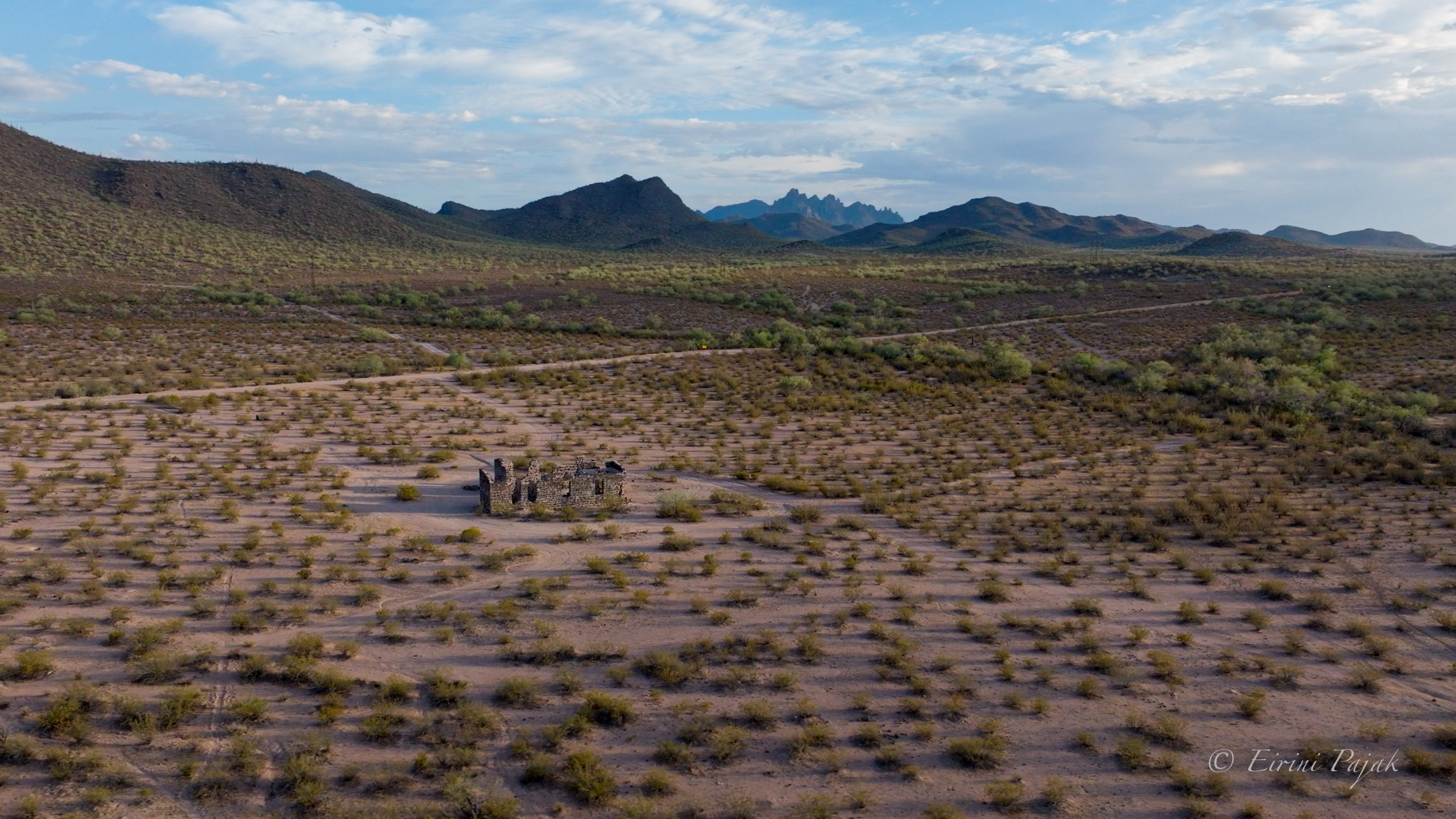
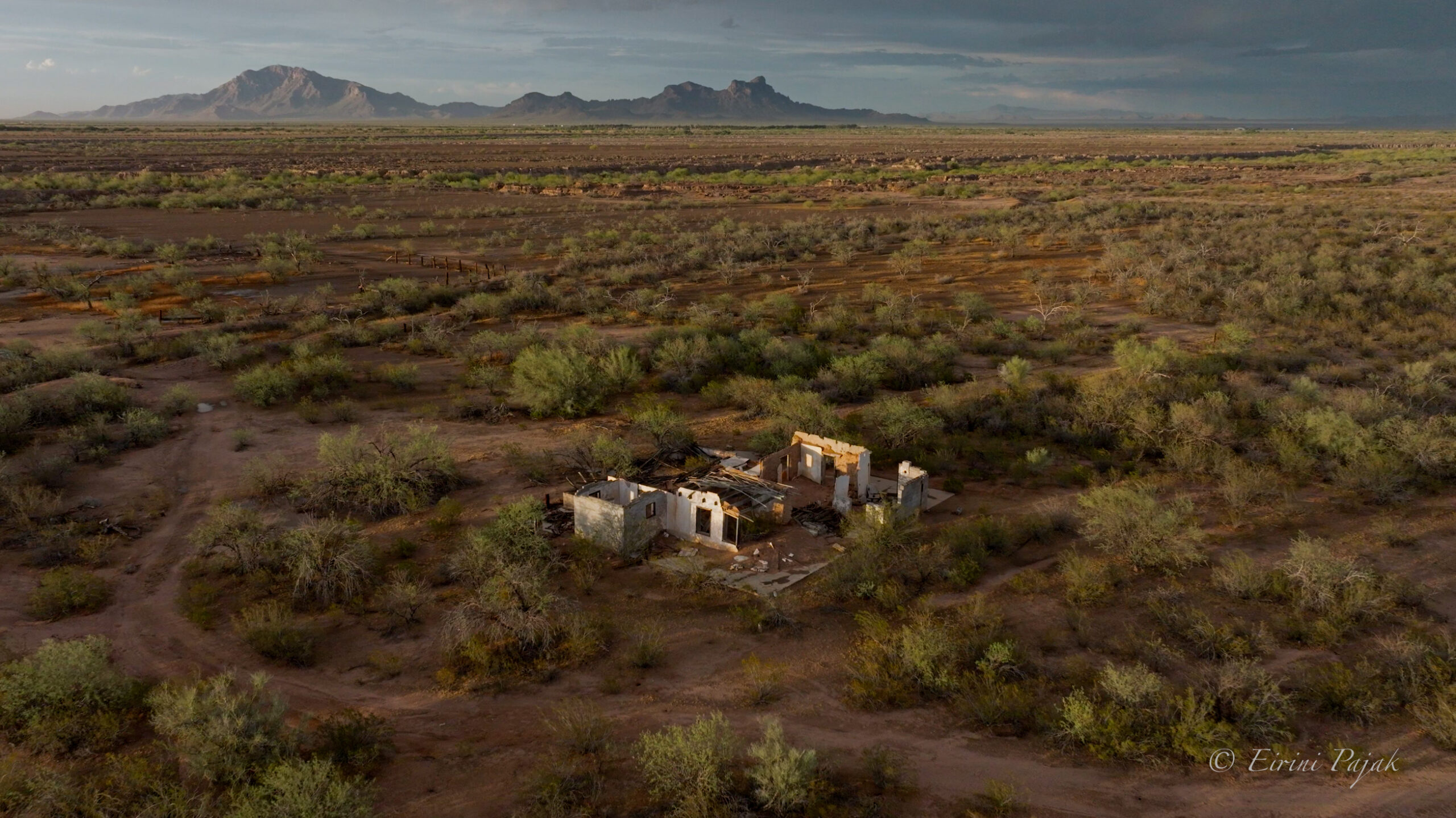
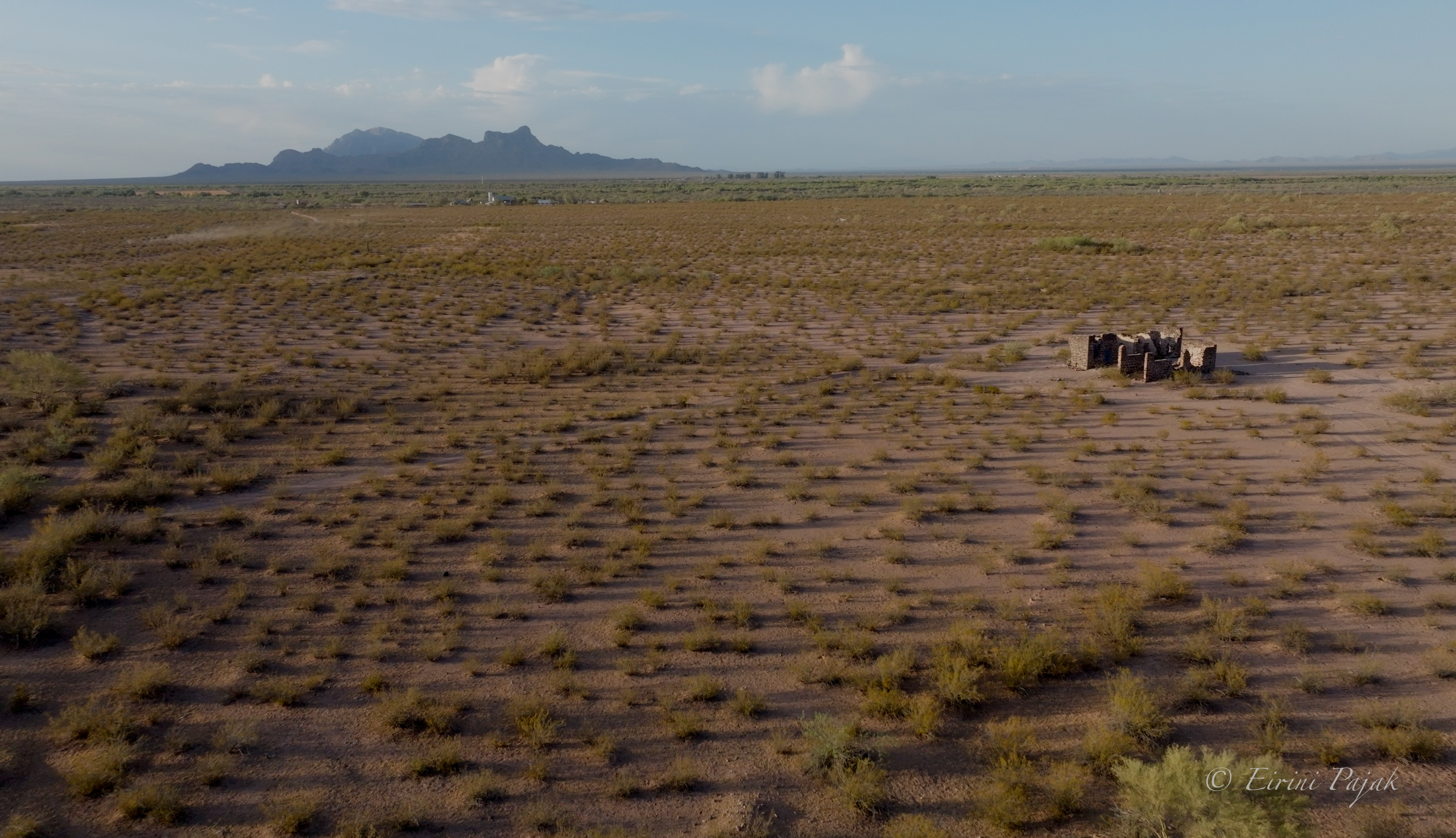
I first photographed the La Osa area in 2018, on assignment for Arizona Highways Magazine’s guidebook, Arizona Ghost Towns. I came for the ruins, the volcanic stone shell of the Hotel Rockland and the smelter foundations at Sasco, where the Southern Arizona Smelting Company housed six hundred to a thousand people before the copper market collapsed and the smelter went cold. The landscape surrounding the ruins is what made them even more special.
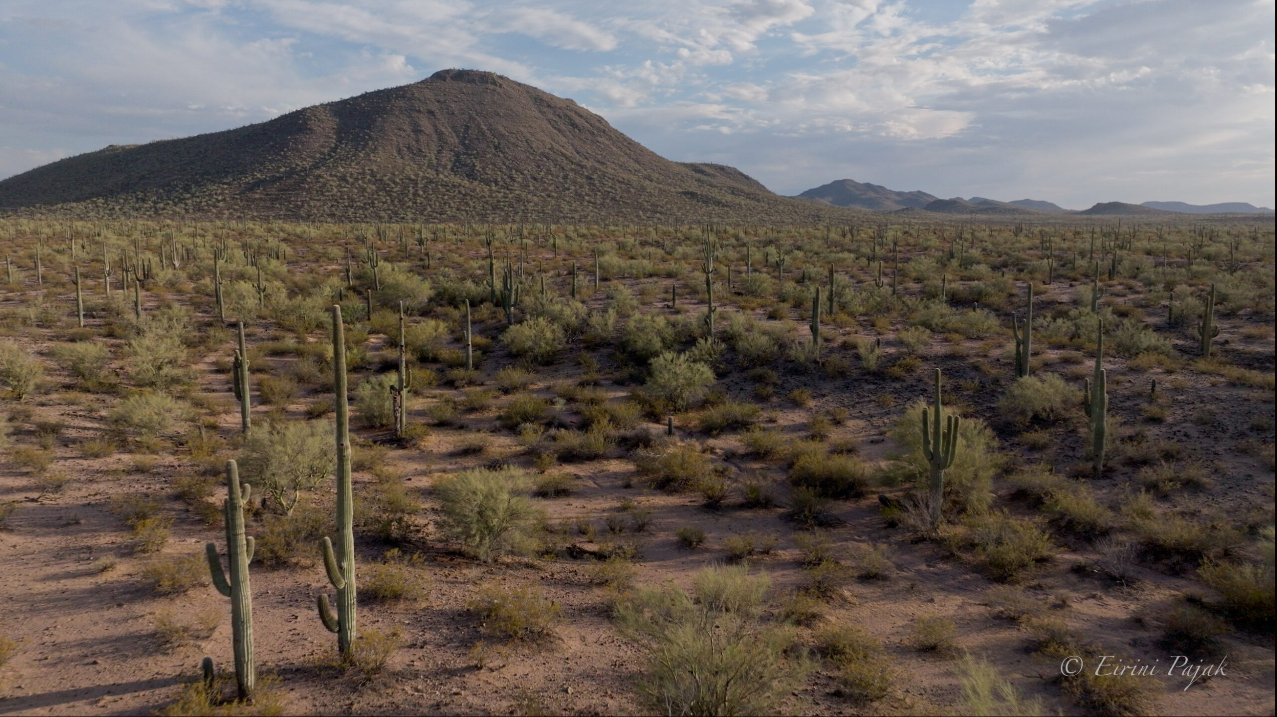
It is beautiful out there. The uninterrupted views run in every direction, the layers of the Samaniego Hills, Ragged Top, Picacho Peak, and a quiet you can feel in your chest.
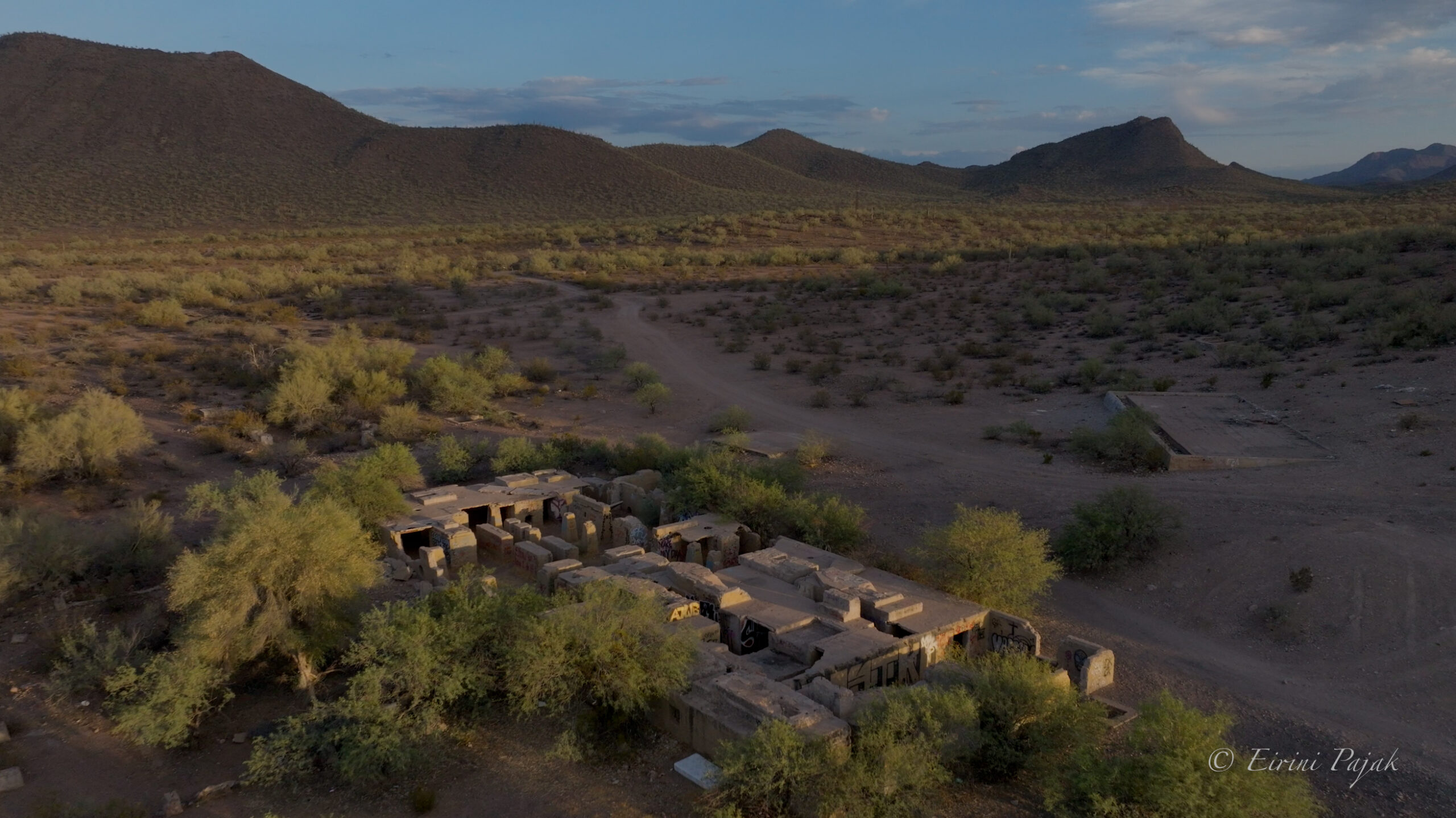
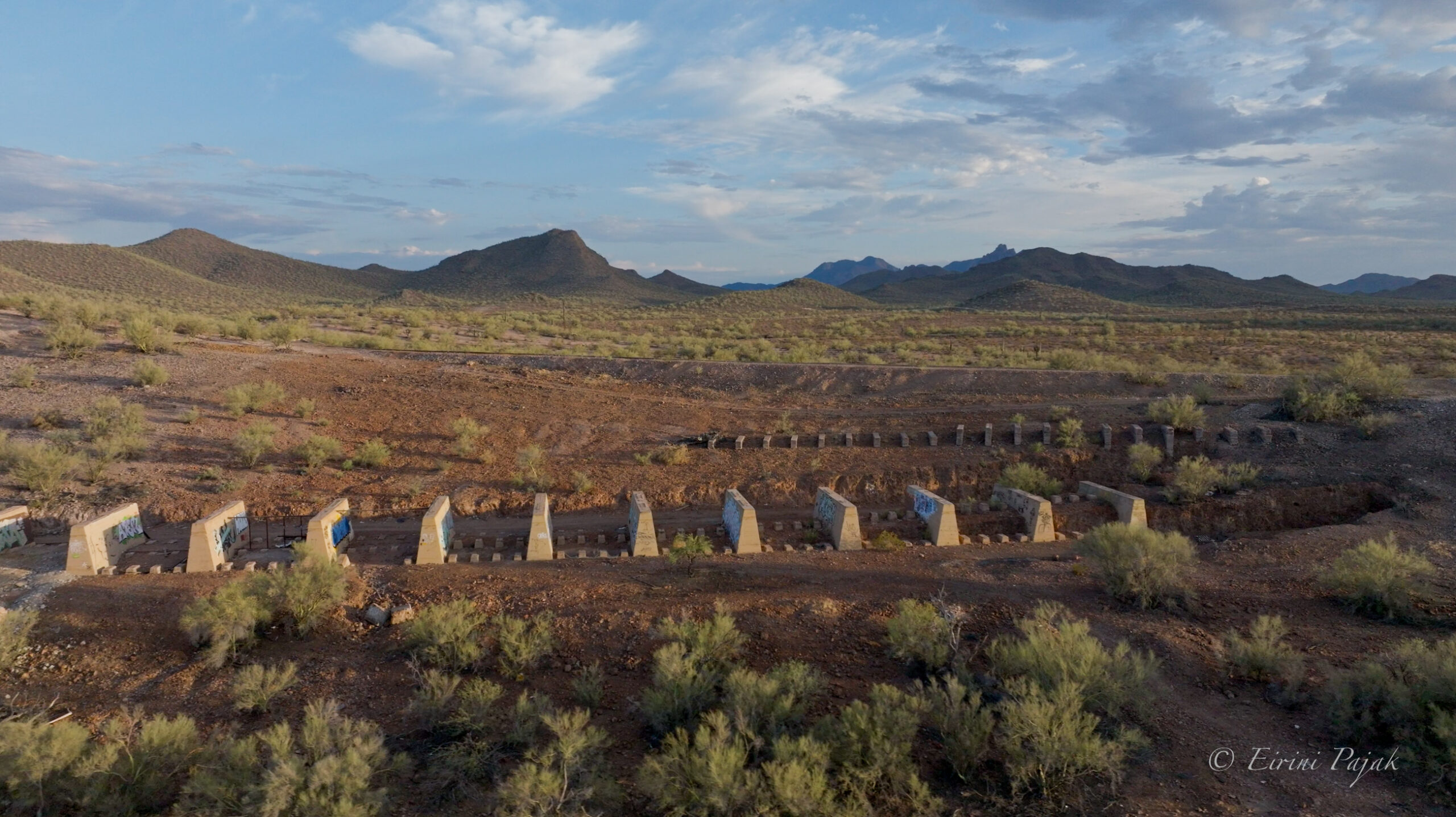
In 2018 I worked from the ground. This footage was shot from the air. It shows Sasco and the Rockland still standing, the crumbling ruins of Gobea’s Ranch, and, running through a chunk of the site, the Ironwood-Picacho wildlife linkage, mapped in Arizona’s Wildlife Linkages Assessment. The corridor is kept open so animals can move between Ironwood Forest National Monument and Picacho Peak. It is meant to carry desert bighorn between the mountain ranges, and it holds habitat for the Sonoran desert tortoise and many other animals, including federally listed species such as the cactus ferruginous pygmy-owl and the western yellow-billed cuckoo.
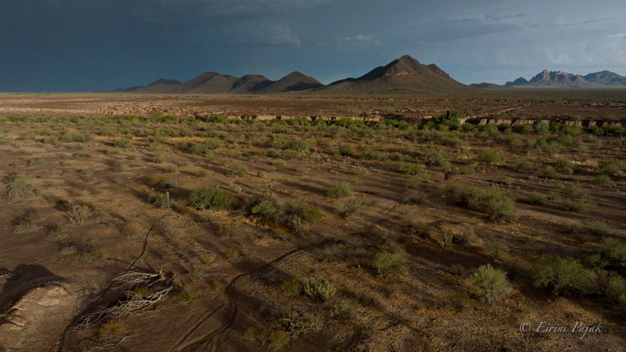
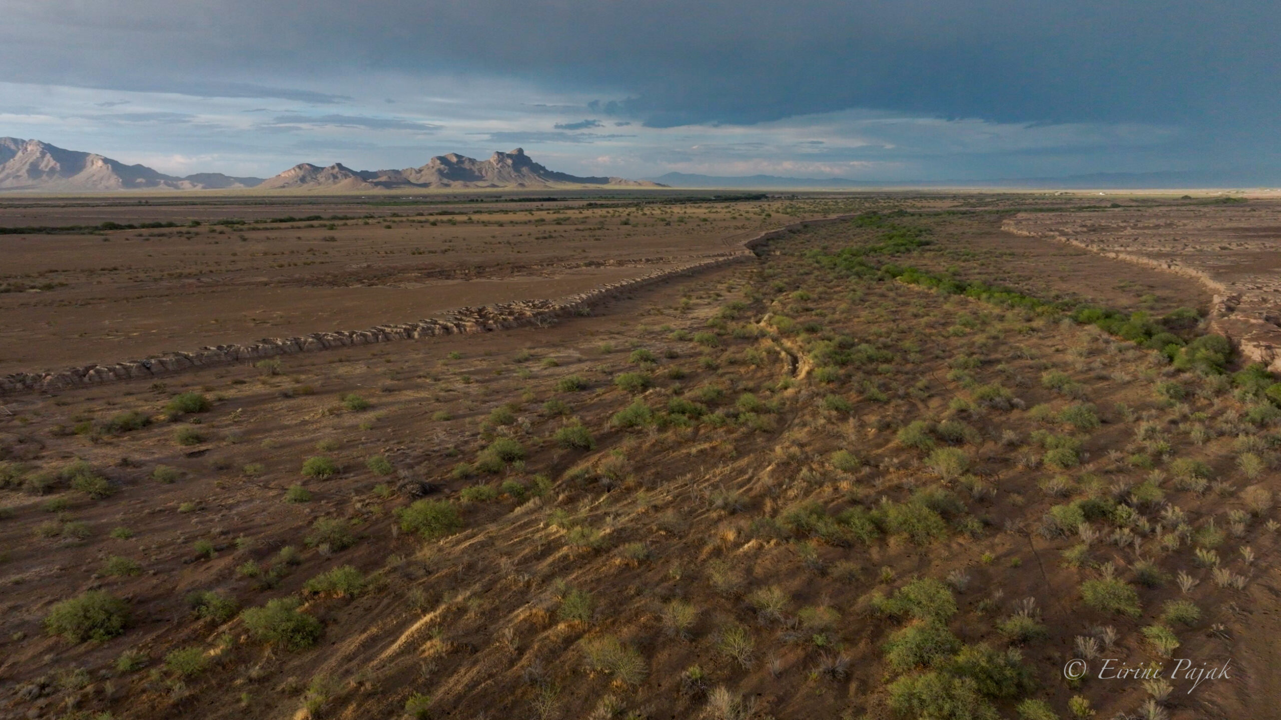
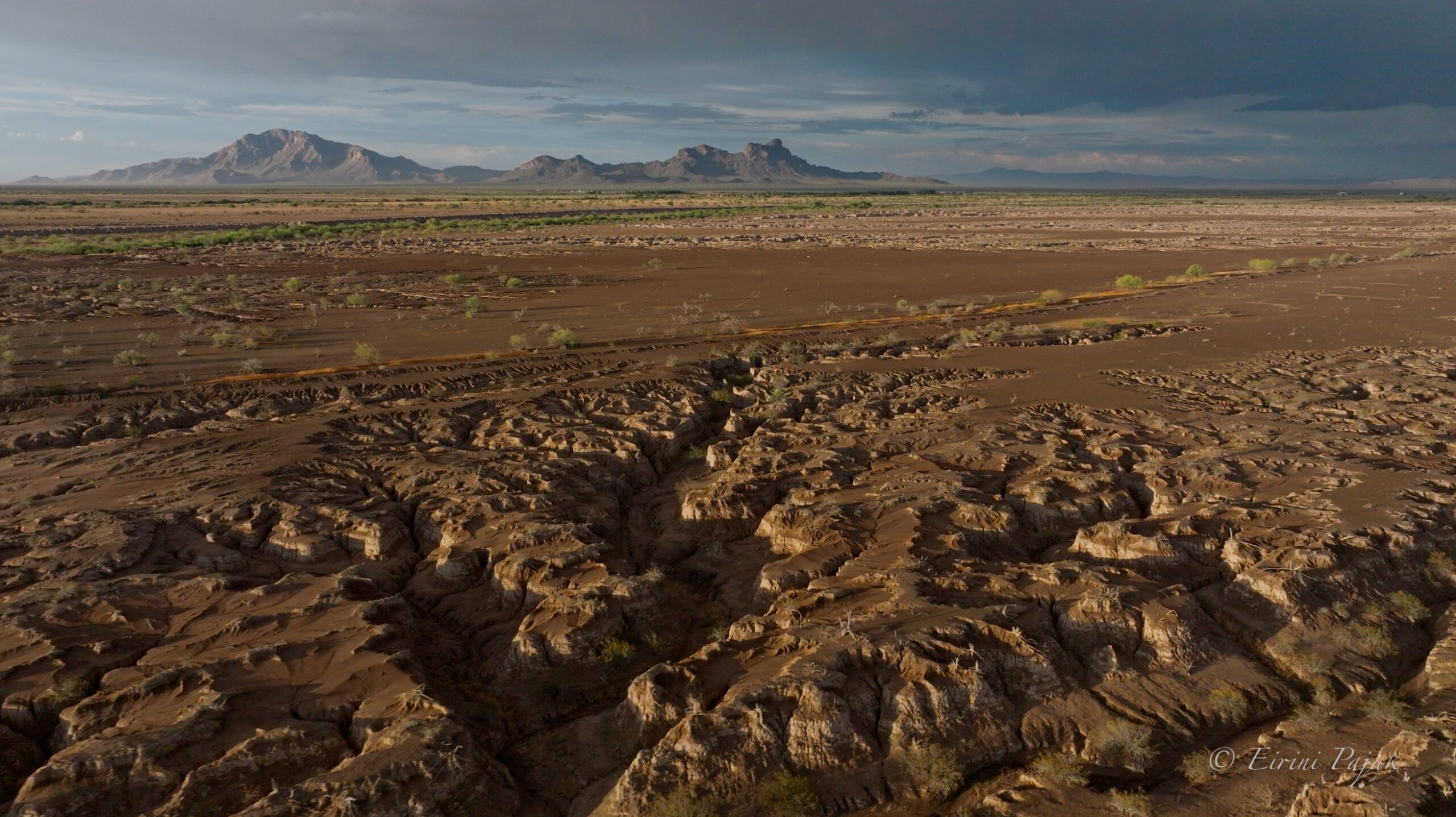
From above, Greene Wash branches across the flats like the veins in a leaf, every fork cut by water that is gone most of the year. And it is not just any wash. A canal was dug across these flats in 1910 to carry the Santa Cruz River’s floodwater to a reservoir. During the floods of 1914 and 1915 the river spilled into that canal and took it over for good. That old canal is the Greene Wash today, and the Santa Cruz, the river that runs through Tucson, has followed it ever since, toward the Gila.
This is the proposed data center site. The hotel, the ranch, the wash, the wildlife corridor all fall across its footprint, and Ironwood Forest National Monument flanks it
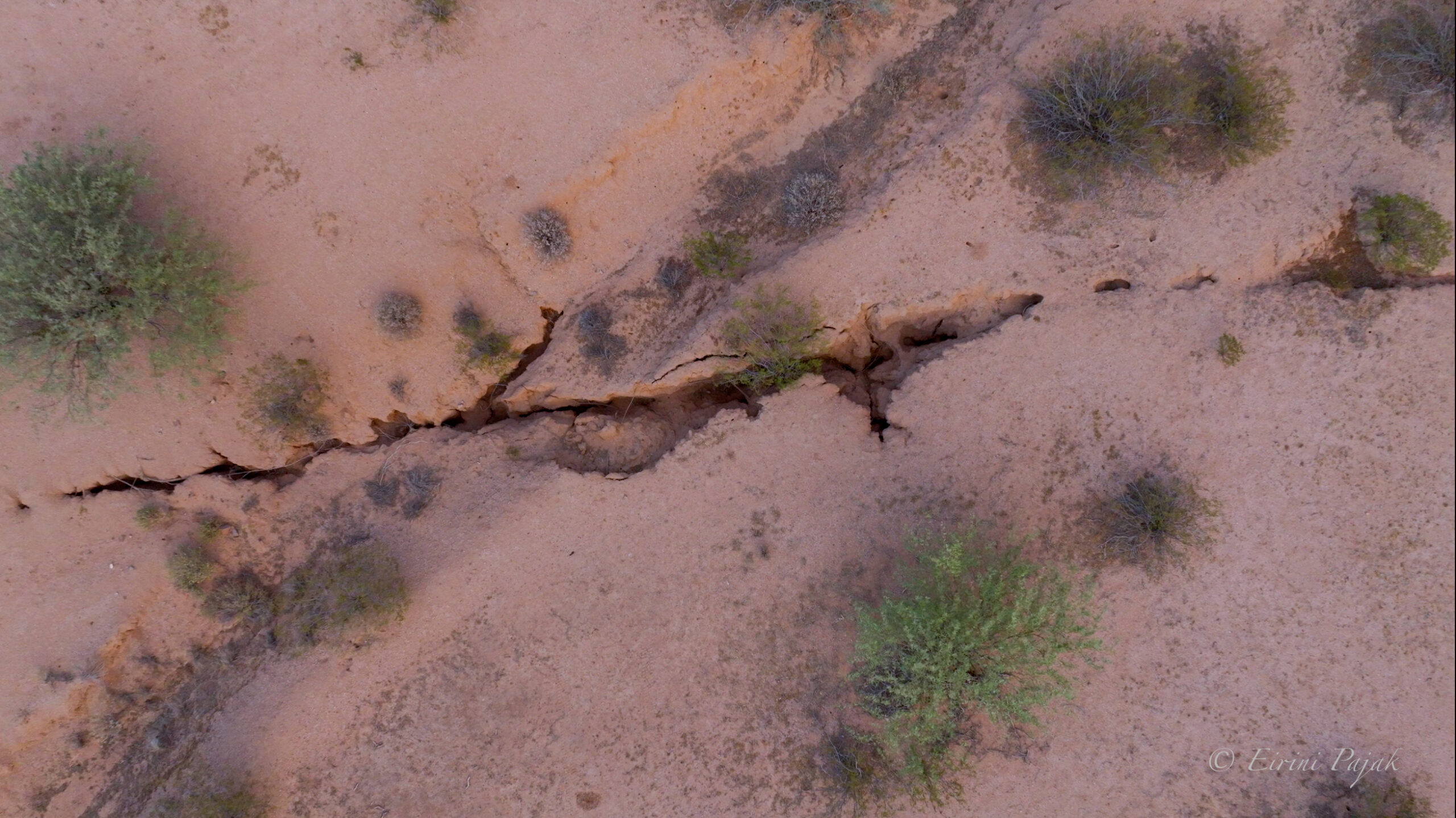
The video ends on a fissure. I have looked at these cracks for years, in photographs, on satellite images, traced from the air, but last week was the first time I stood at the edge of one. It is the wash turned inside out. The banks of Greene Wash were cut by water running over the land. A fissure opens when groundwater is pumped out from under the land faster than it returns, and the ground sinks and pulls apart.
The developer says the project would use very little water and is willing to put a cap on the usage. Water use is self-reported to the state, which regulates a use like this for how efficiently it uses water rather than how much it takes. How or if a voluntary cap like this could be enforced is unknown. I worked through the water numbers in more detail in an earlier piece.
The original plan showed fifty-nine buildings, each roughly nine acres or nearly seven football fields under roof. After public input, the developer said the count would drop to eleven. That reduction appears in the project narrative, the part of the application that is not binding. The rezoning of 2,393 acres from rural to industrial and the Planned Area Development overlay still cover the same ground. Buildings of that size would forever change the landscape. Unlike the stone ruins at Sasco, which have weathered into the desert over more than a century, these buildings will not melt back into it the way the Rockland is doing.
Whether it goes forward, and on what terms, is for the Pinal County Board of Supervisors, who take it up again on August 26.
The Board of Supervisors hears the case on August 26 at 9:30 a.m. at 135 North Pinal Street in Florence. The hearing is open to the public. Written comments can be submitted to the clerk of the board at [email protected], referencing case numbers 2026-PZ-003-26 and 2026-PZ-PD-003-26. Comments sent to the clerk are shared with the full Board and become part of the official record of the case.
Eirini Pajak is a licensed real estate agent, freelance photographer, journalist, and Pinal County resident. She runs the Pinal Code Watchers community group. Her chiweenie Peso joins her on county rounds and features in the photo series accompanying this work.
Guest opinion column by Pinal Unlocked, published in Pinal Post’s Opinion section. Views are the author’s own.