The Florence Town Council unanimously approved a major amendment to the Dobson Farms Planned Unit Development on August 5th, advancing the industrial transformation of northern Florence along a developing transportation and energy infrastructure corridor.
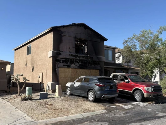
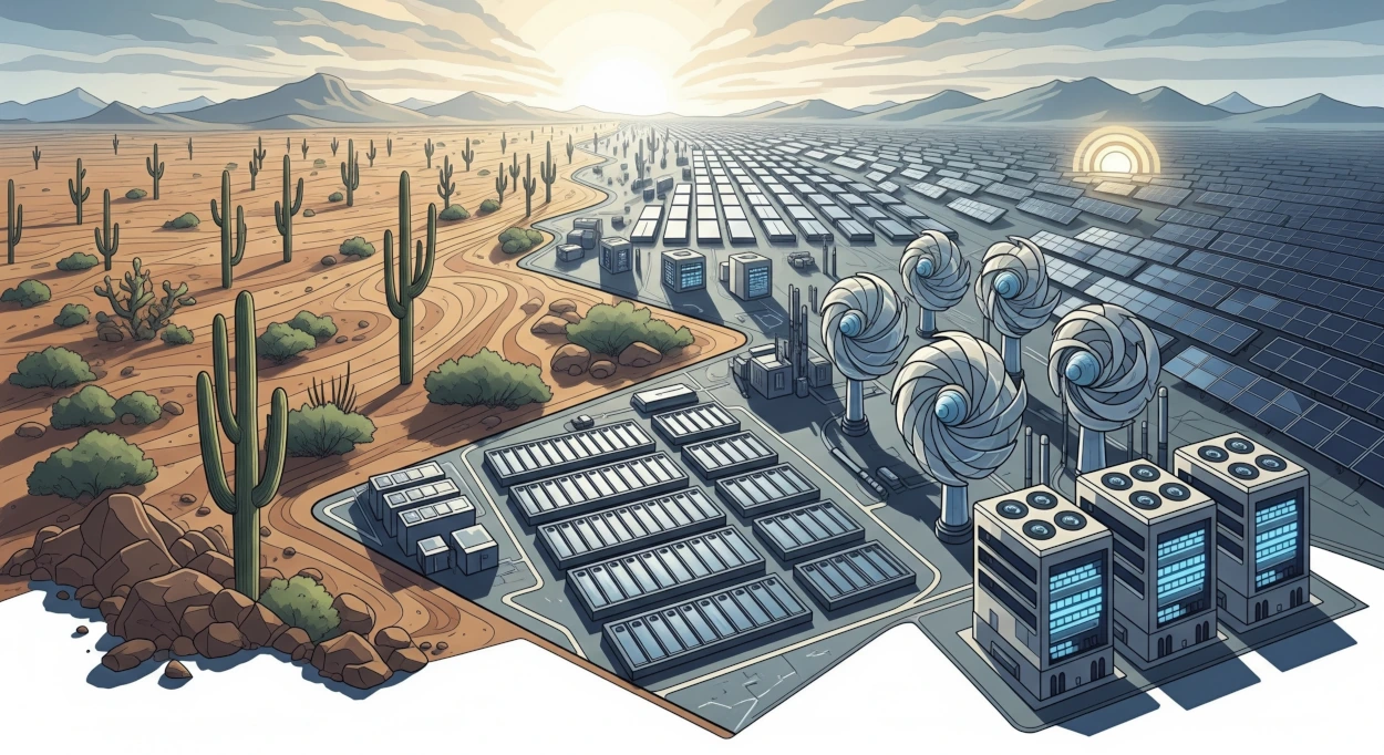
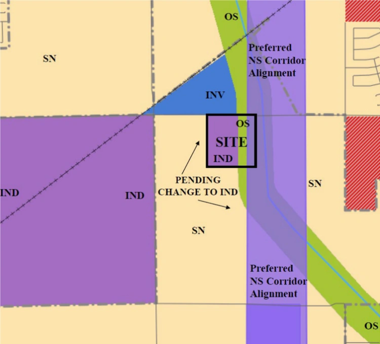
The council voted 7-0 to adopt Ordinance No. 763-25, which changes land use designations from Residential Low to Commercial-Industrial (CI) for a 40.93-acre property within the Dobson Farms PUD intended for the LightHorse Energy Storage project and adds battery energy storage systems to permitted uses under the CI category within the planned unit development.
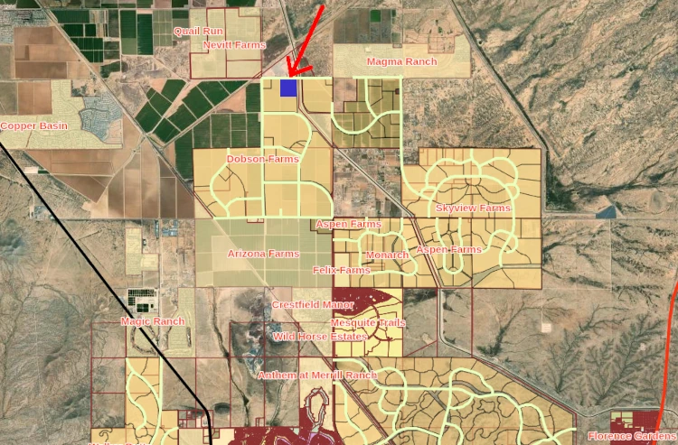
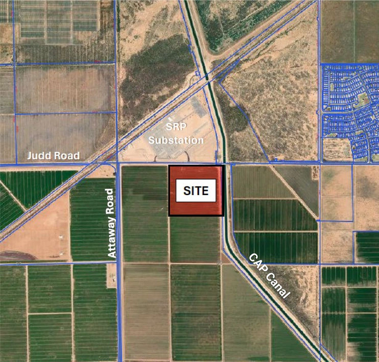
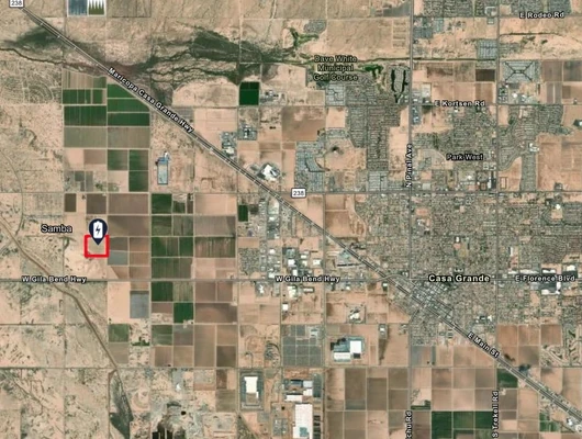
The amendment increases industrial development within Dobson Farms from 65 acres (3.85% of the 1,689-acre PUD) to 105.93 acres (6.27% of total acreage). The LightHorse project site has no homes located within 3,000 feet, reflecting the area’s separation from residential development.
Industrial Corridor Development
Community Development Director A.J. Monroe said “ongoing utility infrastructure investments by SRPs and partners, and the proposed large-scale transportation infrastructure projects of the state and the county prime the northern sections of Florence for industrial development.”
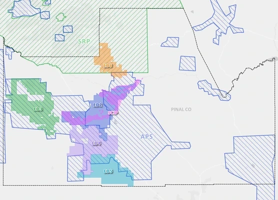
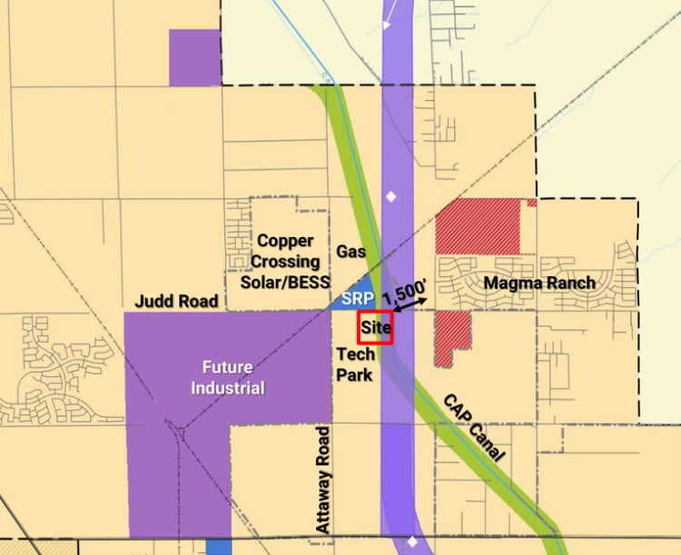
The area already has established industrial uses, including industrial zoning to the west and solar development, BESS development, a gas plant, and the SRP substation on the county side to the north. The LightHorse project’s proximity to the existing SRP substation will minimize required transmission infrastructure in the area.
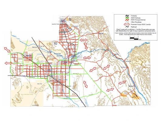
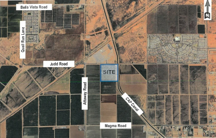
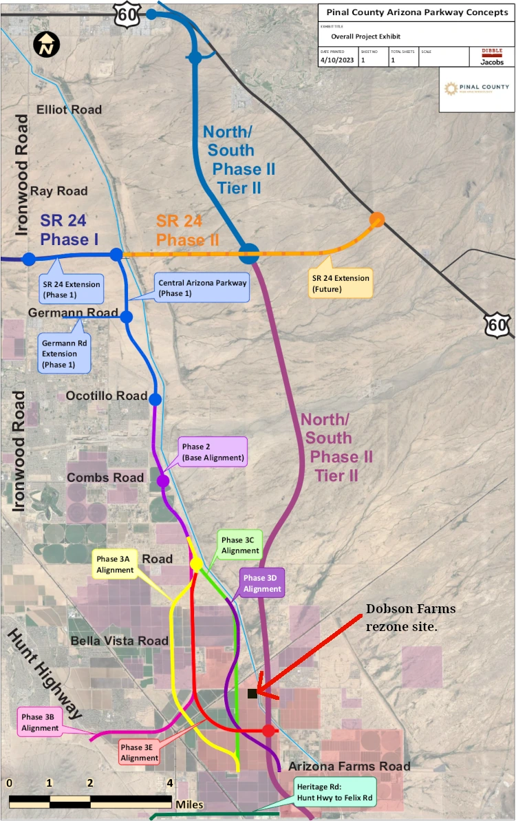
The location aligns with planned infrastructure including the North-South Corridor, a 55-mile planned future transportation route that would stretch from US 60 in Apache Junction to Interstate 10 near Eloy, and Pinal County’s Central Arizona Parkway. The North-South Corridor would carry the proposed designation SR 505, though there is currently no identified funding or timeline for construction. During the August 5th meeting, the applicant said ADOT’s current plan, as they understand it, is to place the corridor’s right-of-way on the east side of the CAP Canal.
Mayor Keith Eaton said the planned highway is reshaping development patterns. “The 505 is changing a lot of the landscape along there and what we’re going to be seeing there,” Eaton said, explaining that developers are now considering industrial uses that would be more compatible with the transportation corridor rather than building residential developments against a future freeway.
Regional Energy Infrastructure Growth
Similar industrial development is occurring in nearby areas. On October 30, 2024, Pinal County’s Board of Supervisors approved the Sunhill Project by a 4-1 vote, redesignating approximately 96 acres from “moderate low density residential” to “employment and mixed-use residential focused development” at the southeast corner of North Felix Road and East Judd Road in the Arizona Farms region of San Tan Valley, just south of the Magma Ranch community. The project designated 80 acres for employment use including data centers and battery energy storage systems, with the remaining 16 acres for mixed-use residential development.
Sunhill (A) to Lighthorse (B) project distance
The Sunhill Project is strategically located near SRP’s Copper Crossing Energy and Research Center, which includes existing and planned solar facilities. The area is becoming known for energy infrastructure development, with multiple battery storage and solar projects planned or operational in the region.
Broader Land Use Changes Expected
Multiple industrial applications are pending for the Florence area, including the Florence Tech Park project to the south and west of the LightHorse site, which is also seeking Commercial-Industrial designation. “In the coming months, what you’ll be hearing from adjacent property owners are major general plan amendments seeking the same industrial place type,” Monroe said during his presentation to the council.
Planning Process and Next Steps
The Planning and Zoning Commission recommended approval with a 4-0 vote on June 5, 2025. A required neighborhood meeting held March 5, 2025, at Magma Ranch Elementary School had no attendees, and staff received no public comments on the proposal.
The approval allows the LightHorse project to proceed to design review and site plan approval processes. The amendment represents the first step in what appears to be a broader industrial transition for northern Florence, with additional similar applications expected as property owners align their land use designations with changing infrastructure and market demands.