Key Points
- Pinal County’s Planning and Zoning Commission voted 8–0 to recommend denial of the 801-acre Silver Reef Solar and Battery Project.
- Commissioners cited insufficient technical details, battery fire safety, and visual and environmental impacts.
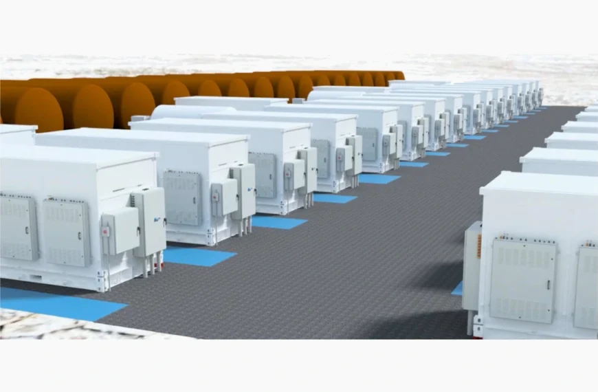
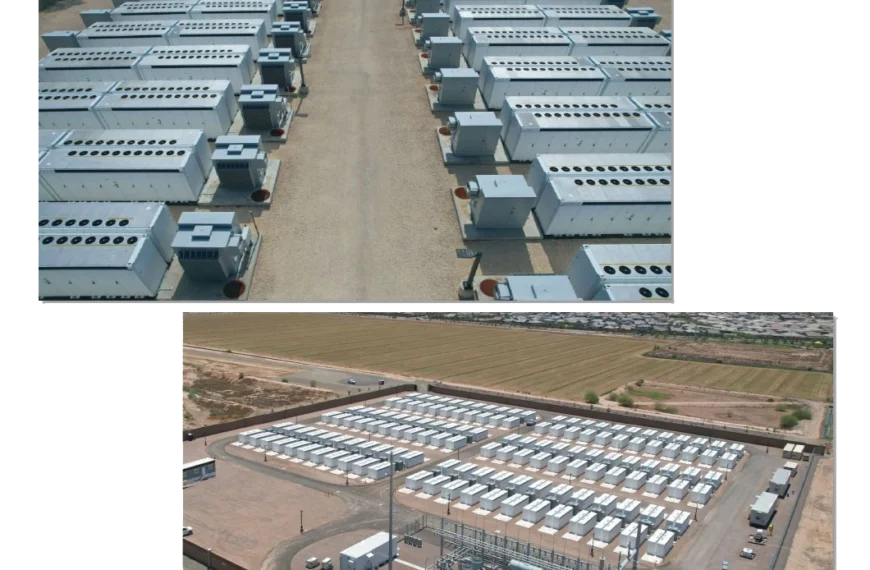
- The project proposed 150 MW of solar and 200 MW of battery storage on land once used as a World War II bombing range.
- Residents voiced concerns about rural character, flooding, wildlife, and benefits flowing outside Pinal County.
- The project would use LFP batteries, considered safer than older NMC types.
- The Citizens Advisory Committee also recommended denial, voting 14–1 in September.
- The proposal now moves to the Board of Supervisors for a final decision.
Pinal County planners cite insufficient information and resident concerns in 8-0 vote against 801-acre facility
The Pinal County Planning and Zoning Commission unanimously voted to recommend denial of the Silver Reef Solar and Battery Project on October 16. The decision followed extensive discussion about battery safety, visual impacts, and the uneven distribution of solar development across Arizona counties.
This article continues coverage from a previous work session in July where commissioners first reviewed the proposal.
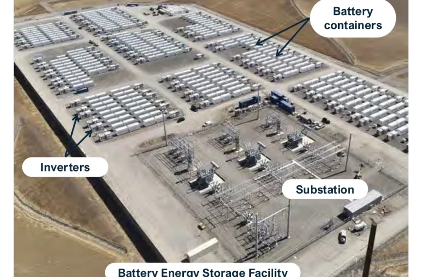
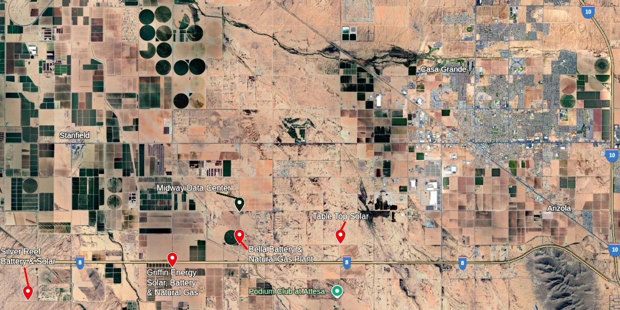
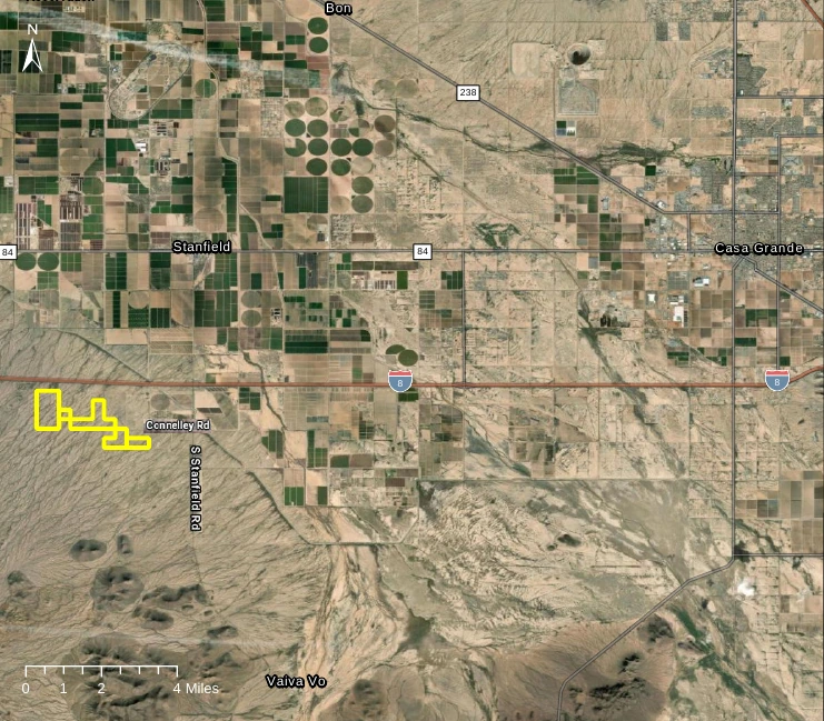
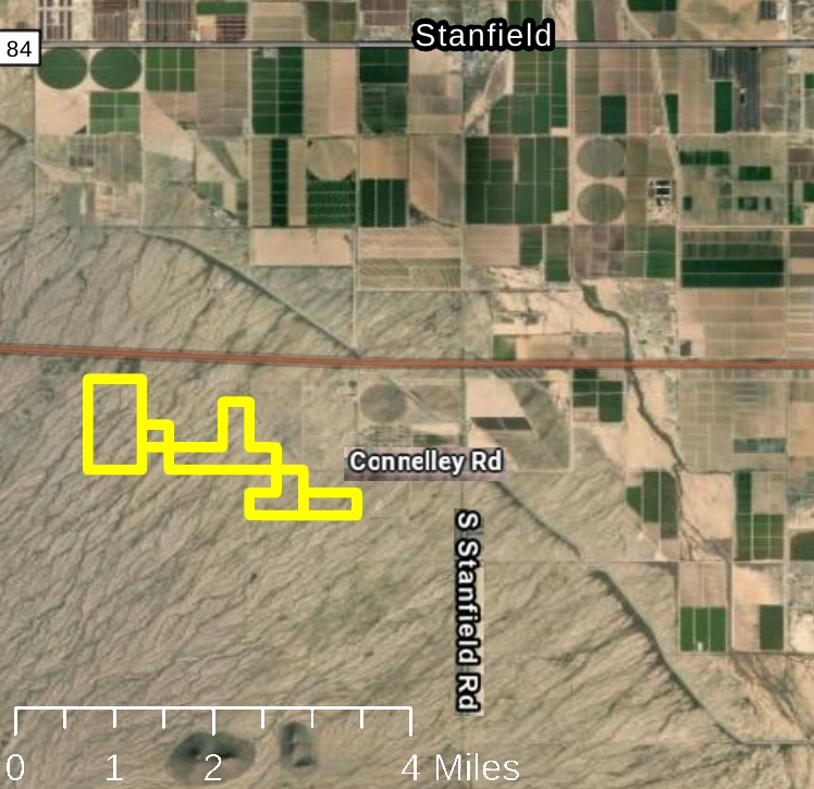
The project seeks to redesignate 801 acres from Very Low Density Residential to Green Energy Production. The site would house a 150-megawatt solar facility and 200-megawatt Battery Energy Storage System. The location is 6.5 miles southwest of Casa Grande, south of Interstate 8.
Project Location and Former Military Use
The Silver Reef site sits on what was once the Williams Field Bomb Target Range #12, which operated from 1942 to 1946, beginning during World War II. An Army Corps of Engineers report from 2009 identified evidence of munitions debris and target debris within the property, along with residual TNT and metals including aluminum, antimony, barium, copper, lead, mercury, and zinc from historic use. These levels were found not to pose unacceptable risks to human health.
Kiersten Stanley, representing Silver Reef Energy and developer Nadara, highlighted this history as a reason the site suits solar development. “Rather than repurposing agricultural land that’s already being used, we do feel good about our site selection,” Stanley said. She argued that redeveloping a former bombing site represents better land use than converting agricultural acreage or low-density residential areas.
The property lies in Flood Zone X, meaning it has minimal flood hazard. However, the site experiences off-site water flows that will require additional drainage analysis. Off-site flows mean water runs across the property from surrounding areas during storms, even though the site itself isn’t in a high-risk flood zone. These flows typically follow natural washes and drainage patterns.
The project would connect to an existing 230-kilovolt transmission line that runs through the property. The nearest homes sit approximately 1,000 to 1,800 feet from the proposed solar arrays.
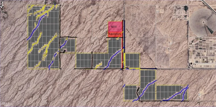
Irregular Property Boundaries Raise Concerns
Stanley addressed concerns about the project’s zigzag configuration, acknowledging community feedback from the Citizens Advisory Committee meeting. “Previously, we were told that individuals felt the project was piecemealed and they would prefer a more cohesive project boundary. We 1,000% understand that,” Stanley said.
She explained that the developer has been actively negotiating with nearby landowners to create a more cohesive boundary but can only work with willing participants. “At the end of the day, if a landowner is not interested in being a part of this project, we can’t force their hands,” Stanley told commissioners.
The applicant turned down several landowners who own property on the eastern side of the project but live 80 to 120 miles away. Stanley explained that including those eastern parcels would make the project more disjointed rather than solve the boundary issue. Negotiations continue with one adjacent landowner whose parcel could improve the project’s cohesiveness.
Native Plant Preservation Plans
The applicant detailed plans for handling protected desert vegetation, including ironwood trees and saguaro cacti. Stanley said the team met with the Arizona Department of Agriculture in late September to discuss native plant protection and permitting requirements.
Stanley explained that protected cacti and ironwood trees could be relocated rather than destroyed. The developer proposed replanting these species along the project perimeter to create a natural visual buffer.
Any plants that cannot be reused on-site would be salvaged to local artists and woodworkers through a notification list maintained by the state.
Battery Chemistry Discussion Takes Center Stage
Commissioner Tom Scott raised detailed concerns about battery fire safety, referencing a recent incident in Peoria. His questions prompted an extended discussion about battery technology that became central to the hearing.
Amanda Hargrave, from consulting firm Tetra Tech, explained that the industry has transitioned away from Nickel Manganese Cobalt (NMC) batteries. She said many battery fires occurred in systems that were not tested as complete units. According to Hargrave, modern manufacturers like Tesla now test entire battery systems as full units multiple times before use.
Stanley confirmed the project would use Lithium Iron Phosphate (LFP) batteries rather than NMC technology. “All these systems that you’re seeing that are catching fire, Moss Landing, Escondido, there have been so many, and this year, well, not that many, but over the past five years, they’ve all been NMC technology, which the industry has pretty much phased out,” Stanley said.
According to a technical comparison from Mayfield Energy, LFP batteries offer significant safety advantages over NMC. The LFP chemistry is more stable and less likely to overheat or catch fire. LFP batteries typically deliver 3,000 or more charge-discharge cycles compared to 1,000-2,000 for NMC. While NMC batteries have higher energy density at the cell level, LFP’s superior safety allows cells to be packed more tightly together. This makes integrated pack sizes more comparable than individual cell density might suggest.
Water Requirements for Fire Emergencies
The applicant proposed having a water tank on-site for landscaping, fire department needs, and potential fire emergencies. Stanley explained that current industry practice for battery fires involves letting them burn rather than applying water directly to the batteries. In fire scenarios, she said, water would be used to wet surrounding areas to prevent fire spread.
Commissioner Tom Scott challenged whether a single water tank would be sufficient. He presented detailed calculations based on a recent battery fire in Peoria, where three fire trucks sprayed water to prevent the fire from spreading to surrounding battery modules.
Scott explained that each fire truck used between 750 and 1,250 gallons per minute. “That’s 45,000 gallons of water in an hour” for a single truck, Scott said. “So now we had three of those trucks spraying that water over there, so that’s 135,000 gallons of water in an hour.” He noted his firefighter contact estimated the trucks operated for four hours.
“But when you’re putting out 45,000 gallons an hour, that’s gonna be good for 45 minutes. How long is it gonna take you to schedule up these trucks to show up so that you can mitigate that fire?” Scott asked, questioning whether emergency response could arrive quickly enough and whether a single on-site tank could provide adequate water supply.
Visual Impact Analysis
The applicant presented a viewshed analysis to address concerns about visual impacts raised at the Citizens Advisory Committee meeting. The analysis used publicly available terrain data to map where the solar facility would be visible from surrounding areas, taking vegetation heights and landscape features into account.
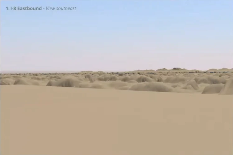
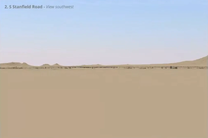
Stanley acknowledged that commissioners and residents had raised concerns about views from Interstate 8, Stanfield, and elevated locations like mountains. She said the facility would inevitably be visible from mountains, as there was nothing the developer could do to prevent that. However, the project would use native vegetation planted along the perimeter to create natural visual buffers for viewers at ground level and from roadways.
Stanley noted that solar panels would be mounted on single-axis tracking systems, installed between 5 to 8 feet off the ground at their lowest point and reaching 12 feet when fully tilted. The project would use bifacial panels with anti-reflective coatings designed to minimize glare.
“We’re using bifacial trackers for these panels, which have even lower reflectivity than traditional one-sided panels,” Stanley said. She provided a comparison showing that the panels reflect less sunlight than common materials like windows, water surfaces, and bare desert soil.
Pinal County’s Disproportionate Solar Burden
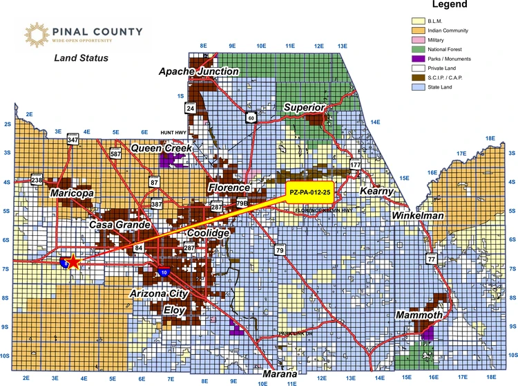
Commissioner Gary Pranzo shared statistics highlighting the county’s outsized role in Arizona’s solar development. “Pinal County is over 30% built in terms of solar power, where all the other counties in Arizona are at 10%,” Pranzo said. “So, this presents a problem for me.”
He expressed frustration about promised economic benefits that fail to materialize locally. “We hear often how much tax dollars it’s gonna generate, and numbers are incredible, 25, $50 million,” Pranzo said. “But the truth of it is, the net proceeds leave the state. And just to drive that point home so that you understand it, Pinal County financially leaks to Maricopa County and Pinal County for commodities, like a sieve. And now, with all the solar farms, our utility dollar leaves the state too. So you can’t just keep putting the money out. And so it becomes something that Pinal County is carrying heavier than the rest of the state. And we’re becoming more and more aware of it.”
Planner Justin Mullis provided statewide energy generation statistics from the US Energy Information Administration: natural gas accounts for 45% of Arizona’s generation, nuclear provides 27%, solar contributes 13%, coal produces 8%, hydroelectric supplies 4%, and wind generates 2%.
Pranzo clarified his concerns: “I’ve seen those numbers. I just don’t want Pinal County doing the heavy lifting.”
Decommissioning and Long-Term Environmental Concerns
Commissioner Karen Mooney questioned the cleanliness of solar technology, referencing damage from severe weather events. “You say solar is clean. Yeah, it’s clean until you have hail or damage, and when they’re shattered, there’s gases in between that are toxic to the soil,” Mooney said. “And the large and the small shards of glass won’t be cleaned out of that soil for years. So, you’re not gonna be able to put cattle back on it if it’s a cattle field or grow crops or allow grazing.”
Mooney referenced incidents in Florida and Texas where hailstorms damaged large solar installations. She emphasized the importance of having decommissioning plans ready for review during the zoning phase rather than postponing those details.
BREAKING: Hail storm in Damon Texas on 3/24/24 destroys 1,000’s of acres of solar farms.
— Corey Thompson (@Roughneck2real) March 25, 2024
Who pays to fix this green energy? @StateFarm? @FarmBureau? @Allstate?
Or you the taxpayer? pic.twitter.com/GpNSaopObZ
The applicant committed to providing a decommissioning plan, cost estimate, and financial assurances. Stanley indicated this is becoming standard practice across the nation for solar developments.
International Investment Flows
Scott questioned the ownership structure of the parent company. When Stanley confirmed that the parent company operates primarily out of Italy with offices throughout Europe, Scott asked, “So, your parent company’s out of Italy coming to the United States and buying property here?” Stanley began to explain that the U.S. operations are a separate business entity.
Public Opposition Details
Staff received two written letters of opposition and seven letters in support before the hearing. However, the hearing drew multiple residents who spoke against the project, describing a peaceful rural lifestyle threatened by industrial development.
Robin Davis, a Hidden Valley resident, questioned whether local residents would benefit from the power generated. She cited Arizona Corporation Commission discussions indicating power goes onto the grid for utilities like APS or SRP to use across their service areas, with excess potentially sold to California, New Mexico, or Nevada. “It does not normally stay in Pinal,” Davis said, meaning the power doesn’t specifically benefit Pinal County residents despite the county bearing the impacts of the facilities. She raised concerns about chemicals leaking from solar panels and questioned whether the county has adequate decommissioning plans.
Shirlene Nelson described living in one of the most beautiful areas of Pinal County in the foothills of the San Tan Mountains. She spoke about millions of caterpillars that migrate through the proposed project area every few years, providing crucial food for birds and other wildlife while helping control vegetation that could fuel fires. “One change can change a million other things,” Nelson warned.
Brian Nelson noted the elevated topography of the site, explaining it sits 160 feet above the City of Stanfield. “It’d be like somebody putting a solar panel farm on the side of San Tan Mountains,” he said, comparing the visual impact to placing industrial facilities on prominent landmarks.
Bob Nelson raised flooding concerns given the site’s washes and drainage patterns. “As the water filters down from the mountains, it goes right down Connelley Road. To the south of Connelley Road is a 40-foot wide wash,” he said. “What do you do with all that water when the rain comes if you wipe out all of those washes? Where’s it gonna go?”
Tena Dugan focused on the comprehensive plan amendment process itself, arguing that the irregular property boundaries would unfairly leave some property owners surrounded by solar development. She noted that state annexation laws prevent cities from leaving property owners isolated in similar ways, and said the same principle should apply here.
Cepand Alizadeh from the Arizona Technology Council offered the lone voice of support during public comment, citing Arizona Corporation Commissioners who advocate for an “all-of-the-above approach to energy” including nuclear, solar, and gas.
Citizens Advisory Committee Recommendation
The Citizens Advisory Committee voted 14-1 to recommend denial at their September 4 meeting. Committee members raised concerns about proximity to residences, water usage for panel cleaning, and environmental and visual impacts to the land.
Unanimous Denial
After public comment and applicant responses, Commissioner Mooney moved to recommend denial to the Board of Supervisors. Commissioner Pranzo seconded the motion. The commission voted unanimously 8-0 to forward a recommendation of denial.
Commissioners did not provide extensive individual explanations for their votes during the roll call. However, the preceding discussion had covered several concerns. These included inadequate technical information, disproportionate burden on Pinal County, uncertain economic benefits to local residents, and impacts on rural character.
The recommendation now advances to the Pinal County Board of Supervisors, which will make the final decision on the comprehensive plan amendment. If the Board approves the amendment despite the commission’s recommendation, the applicant would still need to pursue rezoning. Additional permits would also be required before construction could begin. The applicant had indicated construction would not start until 2028 if all approvals were obtained.