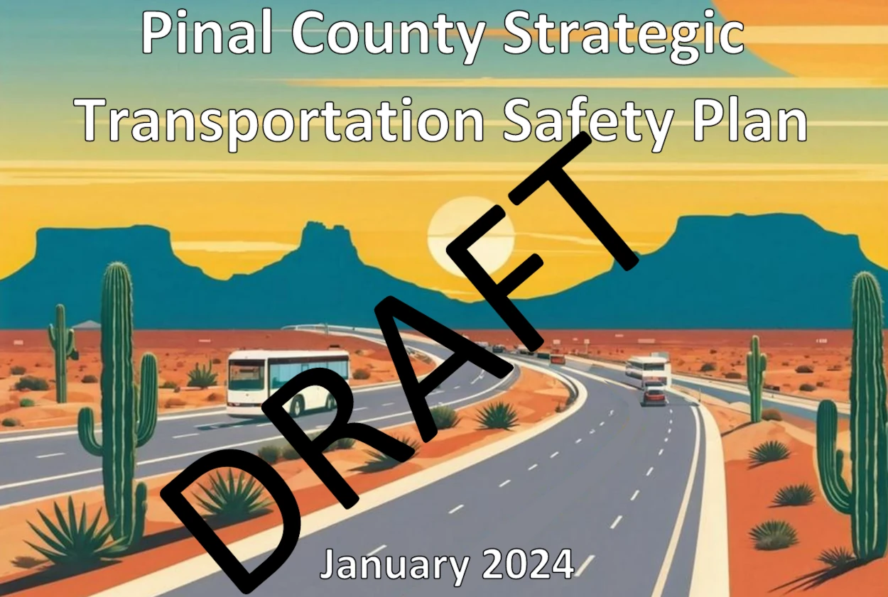
A draft transportation safety plan for Pinal County is now available for public review and comment. The plan, which identifies high-crash locations and outlines strategies to reduce fatalities, comes after analysis showed over 22,000 crashes occurred on county roads between 2018 and 2022.
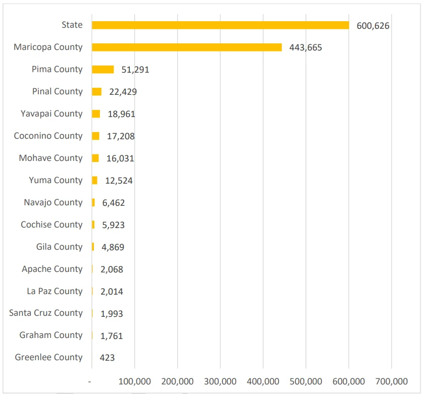
Analysis of crash data from 2018 to 2022 revealed 22,429 crashes in Pinal County, resulting in 360 fatalities and 10,473 injuries. Pinal County ranks third in crash frequency among Arizona counties, with Maricopa County reporting 443,665 crashes and Pima County reporting 51,291 crashes during this period.
[Source: Pinal County, SCMPO]
The Strategic Transportation Safety Plan establishes a framework for reducing fatal and serious injury crashes on public roads in Pinal County by identifying crash trends, emphasis areas, performance measures, high-risk crash locations, funding resources, and potential projects. The plan’s vision is “Striving for Zero Deaths – One is too many!” with a goal to reduce serious injuries and deaths on public roads within Pinal County by 20% by 2030.
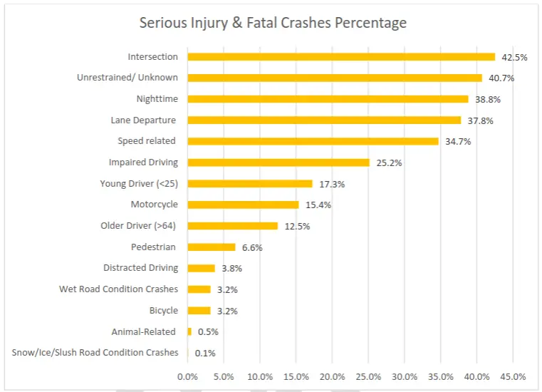
Data analysis shows intersection crashes account for the highest number of fatal plus serious injury crashes at 43%, while unrestrained (no safety device used) crashes represent the second highest at 41%. Nighttime crashes represent the third highest at 39%.
[Source: Pinal County, SCMPO]
Based on crash data analysis and stakeholder input, the plan’s emphasis areas include:
- Behavior Related: Speeding, Impaired Driving, Unrestrained (Not Wearing Seat Belt)
- Intersection
- Lane Departure
- Nighttime
- Age-related: Under 25, Over 64
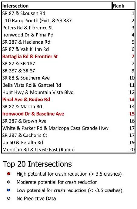
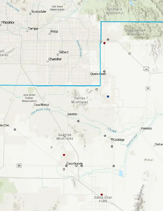
To address these safety concerns, the plan identifies priority locations for improvements. The top-ranked intersection for safety improvements is State Route 87 & Skousen Road, followed by Interstate 10 Ramp South (Exit) & State Route 387, and Peters Road & Florence Street.
[Source: Pinal County, SCMPO]
[Source: Pinal County, SCMPO]
The plan was developed through partnership between the Sun Corridor Metropolitan Planning Organization, Arizona Department of Transportation, Maricopa Association of Governments, Central Arizona Governments, Pinal County, and multiple local jurisdictions including tribal communities and municipalities.
Public Review and Comment Information:
- Public comment period: January 16 through February 15, 2025
- Deadline for submissions: 10:00 a.m. on February 15, 2025
- Submit written comments to: [email protected]
- The complete draft plan can be accessed through the Sun Corridor Metropolitan Planning Organization website
More information on the project can be found on the Sun Corridor Metropolitan Planning Organization site.