Key Points
- Proposal would expand the Tanner Rankin Mine from 60 to 250 acres.
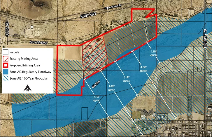
- Site is within a 100-year floodplain, raising compliance concerns.
- Aggregate would supply local construction projects at lower cost.
- No increase in truck traffic expected; operations remain similar in scale.
- First hearing was informational only; more hearings still required.
The Town of Florence Planning and Zoning Commission held an informational session on September 4, 2025, to discuss the proposed expansion of the existing Tanner Rankin Farm mining operation. This was the first hearing, held for discussion and information only. The session focused on a Major General Plan Amendment request that would allow the sand and gravel mining operation to expand from approximately 60 acres to approximately 250 acres. No action or vote was taken during this first public hearing, as the Major General Plan Amendment process requires two public hearings before the Planning and Zoning Commission and one public hearing before the Town Council.
Proposed Mining Expansion
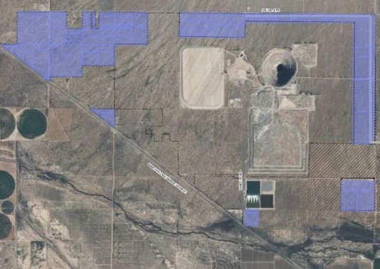
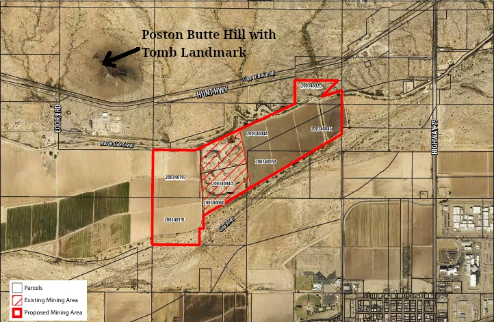
The amendment request, submitted by Gilbert Blilie PLLC on behalf of Tanner Rankin Farm LLC, seeks to change the current land use designations of Suburban Neighborhood, Highway Mixed Use, and Open Space to an Industry District designation and expand the Aggregate Resources Overlay across the site. The expansion would encompass several privately owned parcels located between the northern bank of the Gila River and south of Hunt Highway and the North Side Canal, approximately one-half mile west of Pinal Parkway. The parcels are located in portions of Sections 26 and 35, Township 4 South, and Range 9 East of the Gila and Salt River Base and Meridian.
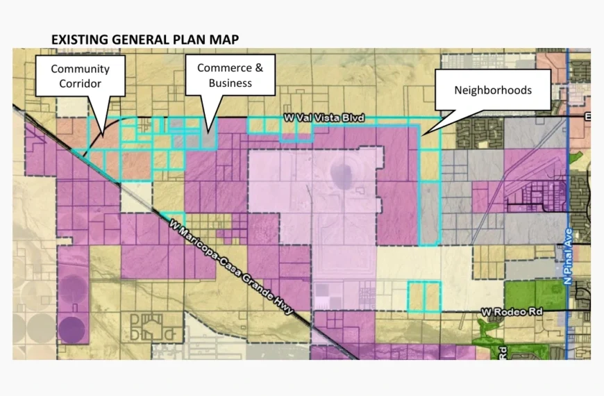
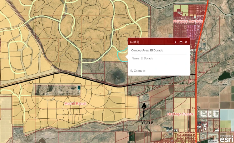
The current land use designations reflect the surrounding context: land to the west is designated as “Suburban Neighborhood” because of the nearby Merrill Ranch Planned Unit Development, land east of the site is designated as “Open Space” because of the Gila River, and land north of the site is designated as Highway Mixed-Use. The site is mostly located within a 100-year floodplain.
Andy Jochums, planning consultant with Gilbert Blilie PLLC, explained: “We are expanding, but we’re not creating a new operation. It’s something that’s already there. No increase in traffic is anticipated compared to current levels.”
The Traffic Impact Statement notes that current levels include about 15 daily delivery trucks and four employee trips, and no increase is anticipated as operations shift within the expanded area.
Jochums continued: “It’s adjacent to other mining operations. As I said, Florence Copper is just to the west. Aggregate resources are important for the growth of the town. Supports reduced costs and emissions. We did hold community outreach as required.”
No public comments were made at the first hearing, though Chairman Frost noted that feedback could come from El Dorado Holdings and Merrill Ranch in future hearings.
Mining Operations and Local Benefits
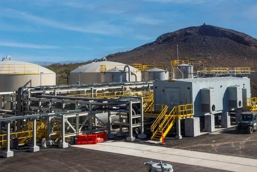
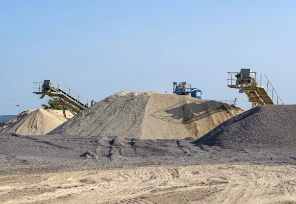
The current mining operation consists of sand and gravel mining, material washing and sorting, and potential ready-mix or asphalt blending operations. The site will be excavated to a depth of approximately 125 feet below the existing ground surface using standard tracked or wheeled construction equipment. Excavated slopes will be limited to no steeper than 3:1 to ensure long-term stability. While blasting is generally not needed for the unconsolidated aggregate deposits, some bedrock formations may require minimal blasting.
The mining operation will require construction of an armored perimeter berm primarily for flood protection, which would also provide some visual screening of the operation.
Jochums emphasized the local nature of the resource: “Because of the weight of it, it really is a resource for the local community. This is a product that is heavy […] it’s not going to move it too far. So the resources that are extracted from this property will be used in the town and the surrounding development. That aggregate is going to be used in just about everything you could think of, from public works projects, to concrete, to any kind of development that’s going to occur at the town in the future.”
Eric Mears, a geologist and consultant with Haley & Aldrich representing Tanner Group, reinforced this point: “Aggregates are extremely heavy. So they double in price about every 10 miles we haul them. So really when you draw a 10-mile radius around the site, that’s really where the primary consumers of these aggregates are.”
Direct Sales and Market Focus
Vice-Chair Kathleen DeRosa questioned whether the company sells directly to developers and the town. Mears confirmed: “We will sell direct to contractors or developers or to the town. The statistics show that about 70% of the aggregates that are sold in the state are actually produced for municipal products.”
Timeline and Future Plans
Commissioner Jeffrey Wooley asked about the anticipated timeline for the expansion. Mears responded that it depends on community development pace, explaining: “It depends on how fast you’re gonna build up your community.” At present production levels, they’re probably looking at 20 to 25 years. “Production will ebb and flow as development ebbs and flows in the community,” Mears explained.
Regarding post-mining plans, Mears noted that every mining project in the state requires a reclamation plan with an associated bond to restore the site. “The post-mine land use hasn’t been selected yet because that’s something that we feel that we will work out with the community as we move through the process,” he said. Mears noted that the Arizona State Mine Inspector process requires a reclamation plan with a bond, and the town would be provided a draft copy of the plan as part of the permitting process. When pressed for examples, Mears mentioned possible post-mine land uses such as flood control, open space, wildlife habitat, or an inert landfill to restore the original land surface.
Floodplain Concerns
Chairman Lonnie Frost argued that the proposed armored perimeter berm designed to prevent floodwater from entering the work site during a 100-year flood event would conflict with the town’s floodplain ordinance by altering floodwaters and pushing them elsewhere. Frost stated they couldn’t legally isolate the site unless FEMA floodplain maps were changed, which he cautioned would be expensive.
Mears acknowledged the concern and explained that the Town of Florence serves as the floodplain administrator, requiring submission of a floodplain easement grant for review. “The project is designed so that it won’t have an upstream or downstream impact associated with the operation,” Mears said. “We can’t just push the water over to somebody else’s property. We can’t erode on somebody else’s property. We can’t have a substantial increase in the flood elevation.” The berm approval remains subject to floodplain regulations and easement review.
Cultural Resources and Trail Considerations
Chairman Frost inquired about cultural resources, noting the area’s history of Native American ruins and sites. Mears confirmed that the site has been investigated where current disturbance exists, but future disturbance areas could require biological and cultural assessments if the operator seeks ADOT source certification.
The chairman also noted that the town’s general plan identifies the northern canal as a corridor for future trails, with the proposed site crossing the canal in the northeast corner. Frost stated: “I just want to put that on the record that we’ve talked about it so there’s no surprises when we come up and say, ‘Hey, time to construct a trail.'” Mears indicated willingness to work with the town and integrate trail considerations into the post-mine land use planning.
What Comes Next
The Planning and Zoning Commission will hold a second public hearing on the Major General Plan Amendment before making a recommendation to the Town Council. The applicant has submitted a comprehensive application package including the Major General Plan Amendment, rezoning from Planned Unit Development (PUD) and Rural Agricultural (RA-10) to Heavy Industrial (HI), a Conditional Use Permit for mining operations, and a Floodplain Use Permit. The additional applications will be presented back before the Planning and Zoning Commission after the general plan amendment has been processed.